Products You May Like
You don’t hike because it’s easy—and these 22 difficult trails are anything but. From airy scrambles to scorching deserts to lung-busting ascents, each of these trips has its own challenge. The good news: the rewards—solitary campsites, sweeping scenery, and sunrises that will burn themselves right into your brain—are more than worth the trouble. —The Editors
Sierra High Route, Sierra Nevada, California
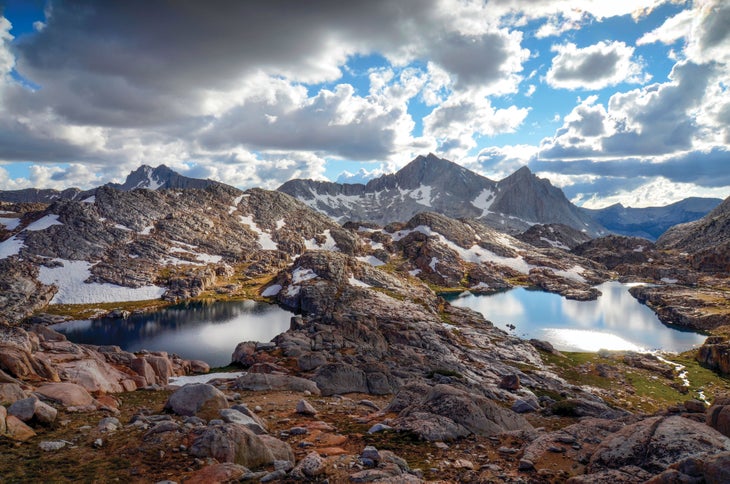
Let others jostle for permits on the John Muir Trail. Get fit for a true alpine test, then set your sights on the 210-mile Sierra High Route. It passes through Muir’s favorite landscape, like his namesake trail, but it sticks to the high ground, making it one of the country’s toughest backpacking routes. Knuckle-busting scrambles over at least 33 granite-filled passes headline the list of cruxes, while the ensuing descents will make your hammies cry uncle. Oh, and the Sierra High Route is often trailless, meaning you’re likely to add extra distance to the claimed mileage anyway (serious navigation skills required). So why’s it worth the effort? Among other reasons: psychedelic alpine meadows, cobalt lakes, granite spires, and enough solitude to make you talk to your boots.
The Sierra High Route connects Yosemite and Kings Canyon National Parks by way of the granite ribs in between. Set aside at least two weeks to do it, and plan on a resupply at Red’s Meadow Resort (they’ll fetch your package from Mammoth for a small fee). You may have second thoughts when humping a week’s worth of food and a bear canister over 12,000-foot peaks on day eight, but once those legs of steel deposit you to camp in Bear Lakes Basin (pictured), you’ll know the lunges were worth it.
Trailhead Road’s End (36.7962, -118.5838) Season July to September Permit Required ($10 + $5/person); obtain from Kings Canyon National Park. Contacts: Sequoia and Yosemite
Long Trail, Green Mountains, Vermont
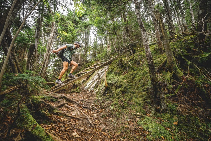
The oldest long-distance hiking trail in America follows the white blazes 272 miles along the spine of the Green Mountains, racking up almost 70,000 feet of elevation change. Still, seen from afar, it looks easy enough, with gentle, rolling mountains and summits that just barely break through treeline. Don’t be fooled: The peaks aren’t what get you. It’s the unrelenting rocks and roots that clutter the trail, leading some thru-hiking vets to declare the Long Trail the toughest long path of them all. It takes a special kind of core strength to stay upright on the off-kilter path. Put your training to the test: From North Adams, Massachusetts, head north, taking at least two-plus weeks to complete the Long Trail. Three-sided lean-tos run its length—between those and the big days, you’re sure to sleep well. Trailhead Appalachia in North Adams (42.7018, -73.1523) Season May to October Permit None Contact
Same Burn, Different Route
Tuscarora Trail, VA, WV, MD, PA The 250-mile Tuscarora takes the Appalachian Trail’s rutted singletrack up a notch (or root, rather). Contact
Pemi Loop, NH In short: 32 miles, eight 4,000-foot peaks, 18,000 feet of elevation change, and infinite knee-hammering rocks. Contact
The Maze, Canyonlands National Park, Utah
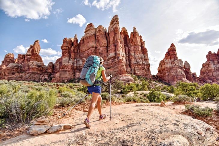
Here’s a trifecta of trouble: zero water, tough footing, and complex navigation (they don’t call it the Maze for nothing). Let’s start with water’s backbreaking arithmetic. At 8 pounds per gallon, you could easily set out with 15 pounds of liquid in your pack just for an overnight. As for your pace? Plan on less than half your typical rate. There’s a reward for all that work, though. It comes in the form of one of the country’s finest desert playgrounds, where blood-red rocks and teetering columns call to intrepid explorers. There, find rock art, slots, and the kind of solitude that can make a hiker wish for company. For a reasonable introduction to the Maze, tackle the 9.3-mile Harvest Scene Loop. It has what you came for: belly-sucking slots, quiet campsites, and some of the area’s most dramatic pictographs. To do it, head out from Chimney Rock Camp, following slickrock through a pair of tangerine-hued canyons before dropping into a wash filled with calf-killing sand. Spend the night at Pictograph Fork near mile 5, just a short walk from the unnamed canyon that holds the Harvest Scene pictograph panel.
Trailhead Chimney Rock (38.1866, -109.9744) Season Spring and fall Permit Required ($30); obtain online. Contact
Lakina Packraft Traverse, Wrangell—St. Elias National Park
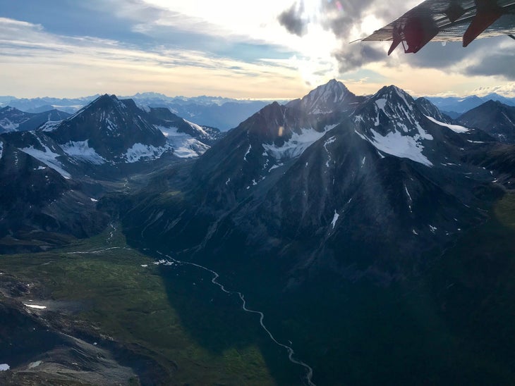
You can only get so far on foot in this park. But for those willing to add an inflatable raft to their pack, the options in the Wrangells go on and on. Packrafting is the only way to score some of the vast park’s premier scenery: sky-blue lakes, groaning glaciers, and valleys that see more brown bears than backpacks. But it’s not that easy; in addition to dead-serious river skills, you need the muscle to paddle slow-moving flatwater, especially when headwinds pick up. Not to mention the strength required to haul your boat on your back.
Build an itinerary along the Lakina River for Class II and III paddling paired with calving glaciers and pinnacled peaks. With 17 miles on the water and as many as 25 punishing overland miles on glaciers, rock bands, and vanishing climber tracks, the whole thing should take at least five days. Get a guide unless you are one.
Put-in Fosse Airstrip (61.5921, -143.0882) Season Mid-August to Mid-September (when the guides run this trip) Guide Kennicott Wilderness Guides (starting at $1,830/person) Permit None Contact
Same Burn, Different Route
Maine Island Trail, ME Explore more than 200 wild islands on this 375-mile, coastal water trail from New Hampshire to Canada. Contact
North Fork Flathead River, Glacier National Park, MT Get a similarly icy experience in the Lower 48 on this 50-mile packraft trip. Contact
Chicago Basin, Weminuche Wilderness, Colorado

Where’s the challenge in climbing just one Fourteener? Tag three on this trip into southern Colorado’s Chicago Basin. After a jaunt into the deeply scooped bowl, you’ll be at the seat of 14,083-foot Mt. Eolus, 14,059-foot Sunlight Peak, and 14,082-foot Windom Peak, a threefer that transforms the skyline into a mid-hike EKG. You don’t need technical know-how to bag them, but physical and cardio fitness are essential.
Do the whole thing, trailhead to trailhead, as a 24-miler over three days. Take Durango’s narrow-gauge train to reach the Needle Creek trailhead, then trek east into the cirque to make a basecamp near mile 7. The approach is fairly cruisey by Colorado standards, so rest up for a big second day, when you’ll rack up more than 10,000 feet of elevation change over 10 miles bagging Eolus, Sunlight, and Windom. From camp, continue about 1.5 miles to the twin lakes at the head of the valley, just below a coronet of Thirteeners. Head west to tick off the most challenging peak first: Mt. Eolus (a few class 4 moves required). Return to the tarns, then head east up the drainage splitting Sunlight and Windom. Grab Sunlight first, then tiptoe back across the class 3 ridge to hit Windom. The spine does dip back below 14,000 feet, but nothing about Chicago Basin’s larger-than-life mountain landscape feels small.
Trailhead Needle Creek (37.6338, -107.6928); take the train to the Needleton stop. Train Durango and Silverton Narrow Gauge Railroad ($89 round-trip + $10 per backpack); durangotrain.com) Season July to September; go mid-week to avoid crowds. Permit None Contact
Same Burn, Different Route
Yellow Mountain Trail, Nantahala National Forest, NC Rhododendrons keep you company on this 12-mile, roller coaster of an out-and-back. Contact
Devils Path, Catskill Mountains, NY Rack up 9,000 feet of elevation change on a 25-mile tour up six peaks. Contact
Four Peaks Motherlode, Tonto National Forest, AZ Four summits in 8 miles—your quads will love it. Contact
Slickrock Creek Trail, Joyce Kilmer-Slickrock Wilderness, North Carolina
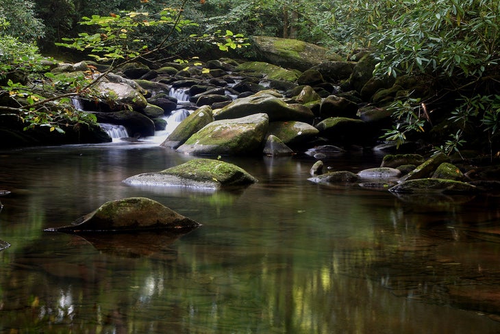
All that stands between you and one of the quietest stretches in the Smokies? A dozen creek crossings. That’s 12—minimum, more in rain—thigh-quivering trips across water that can easily brush the hem of your shorts. But make it to the other side, and you can tick off a 20.4-mile loop that travels beneath some of the oldest trees in the range to an underrated ridge. To do it, follow the Little Tennessee River west to Slickrock Creek, then start splashing. Begin climbing in earnest near mile 7, setting your sights on Stratton Bald. The 5,360-footer offers wide-open views of the southern Appalachians and plenty of space to throw down: Get cozy among the rhododendrons and watch the stars pop above the sloping peaks on the state line. Next day, finish the circuit by connecting the Slickrock Creek, Haoe Lead, Hangover Lead, and Ike Branch Trails.
Trailhead Slickrock Creek (35.4495, -83.9423) Season Year-round Permit None Contact
Frost River Loop, Boundary Waters, Minnesota
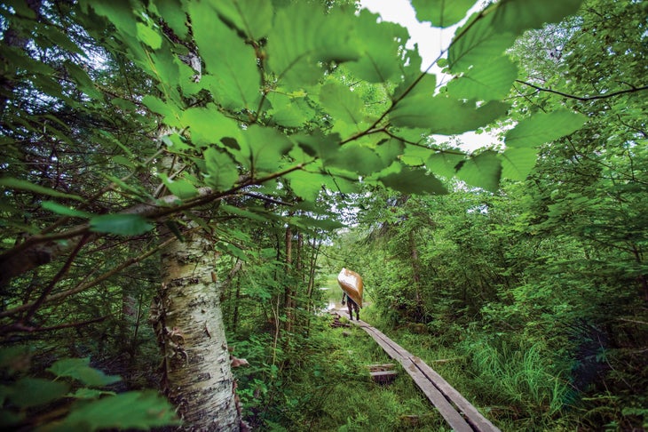
For paddlers, the 1.1-million-acre Boundary Waters is the holy of holies. The liquid labyrinth contains more than a thousand lakes, each seemingly emptier than the last. Loons drift through morning mist, bald eagles swoop dinner from aspen-lined banks, black bears snuffle up blueberries, and paddlers can see it all. But the brochure doesn’t do justice to the core strength canoeing requires—or the muscles and balance you need to haul your boat to the next unspoiled body of water.
You’ll need all of these on the 45-plus-mile Frost River Loop, Boundary Waters’ inner sanctum. The sinuous waterway lets you sneak up on wildlife, provides ever-changing views, and supercharges each turn with a sense of discovery. But it’s not for everyone; the marshy bits mean this loop requires at least four days and 50 portages. That’s more than 10 bouts of lugging your boat and gear over rocks and roots each day, the longest of which is just a hair under half a mile. But your reward is a few dozen remote lakes—on most, you’ll be the only speck of humanity for miles and miles.
Trailhead Sawbill Lake (47.8646, -90.8852) Season May to September Permit Required ($6 + $16/person); obtain from recreation.gov. Contact
Cactus to Clouds Trail, San Bernardino National Forest, California
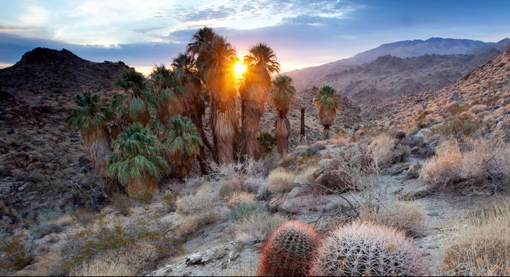
Burn through more than 10,000 feet of elevation gain on your way from Palm Springs to 10,833-foot San Jacinto Peak. In those 13.5 leg-scorching miles, you’ll move from a sunbaked cactus desert to a chilly subalpine forest, so stuff pounds of layers, water, and snacks into your daypack and give it a go.
From the Skyline trailhead, get an alpine start so you’re in the shade of the pines by the hottest part of the day, and pace yourself: There are no obvious breaks in the climb, and it’s almost 800 feet of gain every mile. At the top, earn one of the finest views in California—which might even be an understatement. John Muir called it “the most sublime spectacle to be found anywhere on this earth.” The vista includes the pines of Tahquitz Peak to the south, the Coachella Valley to the east, and the Pacific 60 miles west. To return, head back the way you came. (With a permit, you can tent near the top at Little Round Valley if you can’t stomach a 27-mile, 20,000-foot-elevation-change day, but that means hauling overnight gear.) Or you can catch the tram back down. You earned it.
Trailhead Skyline (33.8253, -116.5504) Tram Palm Springs Aerial Tramway ($26/person); Season November to April Permit None Contact
Same Burn, Different Route
Mt. Whitney, Inyo National Forest, CA Climbing the Lower 48’s tallest peak requires a 6,000-foot day. Contact
Borah Peak, Salmon-Challis National Forest, ID Gain 5,200 feet in just 3.5 miles to highpoint Idaho. Contact
Rim to Rim, Grand Canyon National Park, Arizona
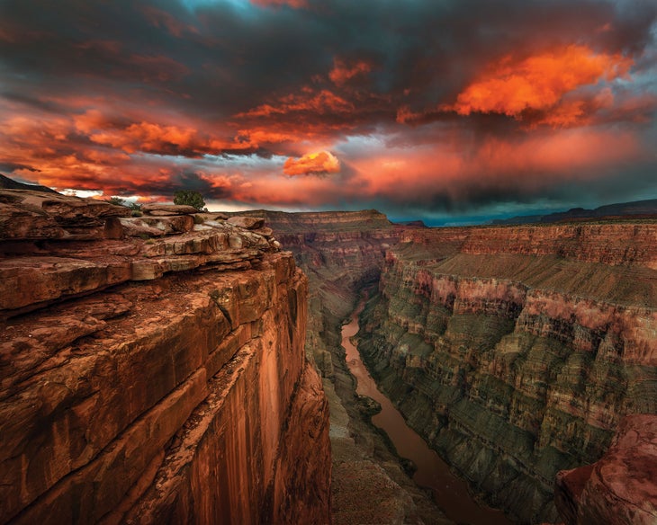
No lineup of hard hikes would be complete without this plunge into the Big Ditch. It’s more than a vertical mile from the rim to the Colorado River, where you can soak your trembling quads and swollen feet as you build yourself up for the climb back out. If you think that the Grand Canyon’s charms go without saying, refresh your memory with the bottom-up view from your sleeping bag: a fat slice of stars strung between orange walls. You’ll want a night to recoup your muscles anyway.
Instead of joining the conga line on the corridor trails, we recommend heading out farther west along the North Rim. Find details and a route for you at backpacker.com/grandcanyon.
Trailhead Bill Hall (36.4346, -112.4300) Season May to November Permit Required ($10 + $8/person per night under the rim); apply online. Contact
Presidential Traverse, White Mountain National Forest, New Hampshire
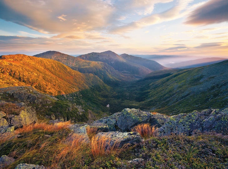
Check your ego before taking on this New Hampshire classic in a day. Considered tough as a two- or three-day trek, the 24-mile Presidential Traverse is altogether ridiculous when done from sunrise to sunset. It crosses eight rocky summits above 4,000 feet, tallying nearly 9,500 feet of elevation gain. And you don’t even get switchbacks to ease the pain. The trail charges straight up each fall line and down the other side, all the while doling out constant views across the most dramatic peaks in the east, passing alpine plants found nowhere else in the world, and mainlining a bucket list of summits in a single go.
Pick a long summer day and start at the Appalachia trailhead on the north end so you can tick off the hardest peaks when your legs are freshest. It’s about 3.5 miles (and a quad-shivering 4,050 feet of gain) to peak number one: 5,367-foot Mt. Madison. Time it so you’re cresting the summit when the sun emerges over Mt. Moriah, turning the gray massifs a misleadingly gentle pink—from here, you’ve got at least another 12 hours to go.
Feeling in over your head? Most of the peaks along the southern half of the Presi have work-arounds. You can also veer below treeline to overnight at or tent near any of the shelters along the way (Perch is a good one, about a third of the way in).
Trailhead Appalachia in Randolph (44.3716, -71.2893) Season June to September; go mid-week to avoid crowds. Permit None Contact
Disappointment Cleaver Route, Mt. Rainier National Park, Washington
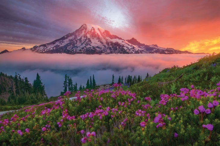
The elevation gain here alone would be challenge enough. Toss in unpredictable weather, an alpine start, crevasses, and the added strain of working at altitude, and you get the Lower 48’s undisputed champion of hard hikes. In fact, fewer than half of those who try actually reach the tip-top of 14,410-foot Rainier. Don’t be one of them: It’d be a crying shame to waste your guide fee on a nice jaunt up to the halfway point, so get big-mountain fit before attempting a climb. From Camp Muir, there are a few ways to the summit, but for the classic, head up the peak’s east flank via the Disappointment Cleaver Route. The climb is sure to earn you bragging rights that outlast the burn.
Trailhead Paradise (46.7861, -121.7351) Season Mid-May to September Guide RMI Expeditions (starting at $1,163); rmiguides.com Permit Required ($20); included in guide fee, or apply online to go without a guide. Contact
Same Burn, Different Route
Mt. Shasta, Mt. Shasta Wilderness, CA No matter which route you choose, it’s 8,000 feet of gain to tag this Fourteener. Contact
Mt. Hood, Mt. Hood Wilderness, OR This climb has merely 5,000 feet of gain, but it requires technical chops to get past 11 glaciers. Contact
Packing for a Hard Hike
If you’re planning on tackling one of these tough trails, careful gear selection can give you a leg up. Look to shave weight where you can without neglecting features and protection.
Backpack: Once you’ve gotten your kit pared down, consider a frameless backpack or one with a light foam backpanel. The Editors’ Choice-winning Mountainsmith Zerk 40 is a good place to start.
Shoes: Your footwear depends heavily on what kind of terrain you expect to encounter and what load you’re planning on carrying. If you don’t need robust ankle support, look at a lightweight trail runner. We’re longtime fans of the Altra Lone Peak series, or the Timp on hardpacked or rocky trails.
Shell: Leaving the shell at home is a rookie mistake, even in summer. Instead, bring a lightweight outer layer that you’ll barely feel in your pack. We recommend the Rab Phantom Pull-on, another Editors’ Choice winner.
