Products You May Like
For all the joy to be found beside lakes and rivers, in valleys and on summits, ridgelines have one big advantage over other terrain: You can follow them for miles, with the world falling away to either side of the narrow trail. Sure, it usually means tough hiking, but once you’re up there, you can spend an entire day enjoying the kind of panoramic views that you’d only find once or twice on lesser hikes. These ten trails will give you all of that and more, from a park world-famous for its biodiversity to a weeklong traverse along the spine of an island.
Sugarland Mountain, Great Smoky Mountains National Park, TN
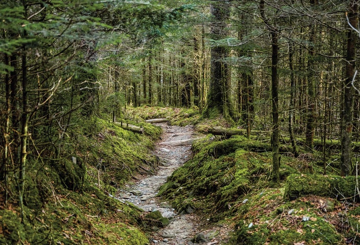
- Distance: 12.3 miles
- Time: 1 day
- Elevation gain: 2,335 feet
This point-to-point follows a miles-long crest through nearly every major ecosystem found in Great Smoky Mountains National Park, delighting photo-chasing hikers and science buffs alike. Winding from Spruce-fir forest at the park’s high point, Clingmans Dome, to rhododendron groves and river valleys thousands of feet below, this trail has a bit of everything. Start from the top for a long, swooping descent, or from the bottom for a serious cardio challenge. Views from the upper end of the trail spread over the entire park, taking in the rolling, parallel ridges of the Smokies, the deep valleys below, and, if you time it right, some really spectacular light at sunrise or sunset.
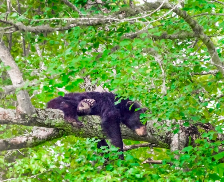
It isn’t just a shifting plant community you’ll see change as you descend Sugarland. While deer and black bear enjoy the upper elevation forests, salamanders prefer the damp lower slopes. Keep an eye out for wildlife both above and underfoot as you follow the spine of the mountain downwards.
The Trail
Drop one car at the Laurel Falls trailhead, then head up the road to Clingmans Dome, the highest spot in the park at 6,644 feet. From the Dome, head down a short access trail to the Appalachian Trail and turn left. About .3 mile from the AT junction, the trail meets the Sugarland Mountain Trail; turn right. Briefly climb upwards as the ridge narrows, passing beneath the peak of Sugarland Mountain, then start the drop to the valley floor around mile 2.3. At mile 4.8, stay straight at a junction with the Rough Creek Trail. At mile 12.3, reach the Laurel Falls Trailhead and your shuttle car.
World Heritage Status
As well as being a US national park, the Great Smoky Mountains are an UNESCO World Heritage Site. The reason? Ecological diversity. With over 3,500 different plant species, nearly as many different types of trees as can be found throughout all of Europe, and likely the widest variety of salamanders anywhere arond the globe, the Smokies are one of the best-preserved temperate forest ecosystems anywhere in the northern hemisphere. The largest stand of virgin red spruce on earth is found in the park, as well. One reason for the incredible biodiversity? When most of the continent was covered by ice sheets during the Pleistocene, the Smokies remained unfrozen, giving the area a head start on plant and animal development over the scraped-bare areas around them when the ice retreated.
Greenstone Ridge, Isle Royale National Park, MI
- Distance: 42 miles
- Time: 3-5 days
- Elevation gain: 4,320 feet
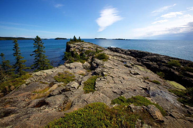
This boat-access-only weekend or weeklong point-to-point has it all: Wildlife, Great Lakes views, and solitude. And it’s understandable: Serious elevation gain, length, and the ferry ride required for access keep the crowds away. For those willing to brave the hurdles, though, Greenstone Ridge is a life-list-worthy trek. After the seven-hour ferry ride (bring a book, or maybe a pillow), most hikers start from the east end of the island, following the rocky spine of Isle Royale through thick forests and grassy meadows. Remote, little-visited lakes dot the crest, perfect for a quick dip on a hot summer day. In late summer and fall, berries line the trail, providing snacks by the handful. On the trail’s high points you can take in panoramic views of Lake Superior and the isle itself, with sightlines stretching unimpeded to the lakeshore 50 miles away.
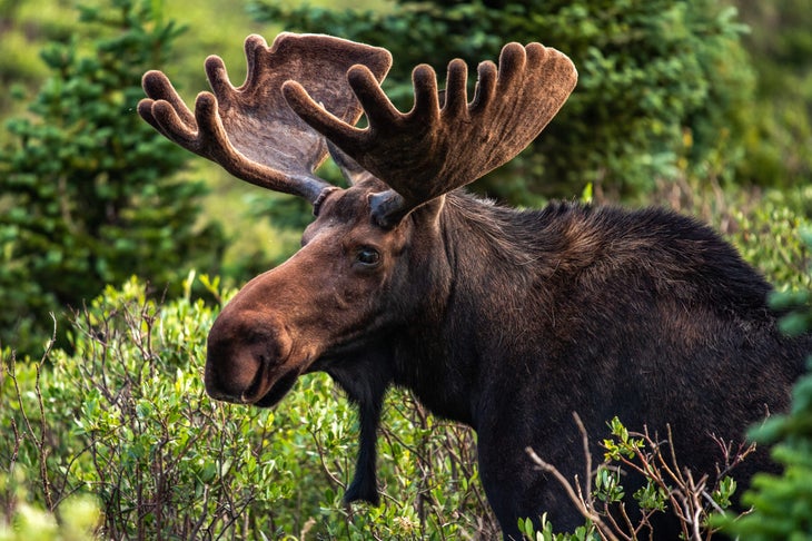
One of the best parts of the Greenstone Ridge hiking experience, though, is the wildlife. A pack of wolves roams from one end of the island to another, their eerie howls rising to greet the moon on many nights, and lucky hikers can spot moose feeding at inland lakes. With the wolves as their only predator, the moose population is mostly controlled by winter vegetation scarcity. Keep an eye out for one or more as you hike past ponds below the ridge crest.
The Trail
From Rock Harbor (the ferry stops here), start your climb in boreal forest on the way up the ridge, which dips from 280 to 800 feet above the waters of Lake Superior as it crosses over six different peaks. Nine different campgrounds along the route offer an array of possible stopping points for each day, depending on how much daily mileage you want to cover. Many hikers finish a short (3 mile) day 1 at Three Mile Campground, where you can pitch your tent right on the shore of Lake Superior. Eleven miles from Three Mile Campground is Chickenbone Lake, another great camping spot. For hiking days that max out just over 10 miles, Lane Cove, Hatchet Creek, and Island Mine make good nightly stopping spots. Make sure to check the ferry schedule and time your arrival at Windigo, the western terminus, to coincide with the ferry you want to catch.
Royale Resupply
If there’s anything more chilling than showing up at the trailhead and realizing you forgot something important, it’s doing the same thing on an island wilderness. Luckily for those of us who are prone to lapses of memory at the worst time, the Rock Harbor Store (open from May 22 to September 11) carries a small variety of grocieries, freeze-dried food, camping supplies, and various sundries, as well as offering showers and laundry.
What is Greenstone, Anyway?
The eponymous ridge is made of basalt, erupted from a series of rifts in the Earth’s crust 1.2 billion years ago. The ridge of Isle Royale was forced upward by a later fault system, pushing the old volcanic rock above the deep basin of Lake Superior. The distinctive pattern of parallel ridges seen in the basalt today was further exposed by repeated glaciation between 1 million and 10,500 years ago, which also left the striation marks that hikers can now see on some rock slabs on the island. The ridge pattern continues beneath the water, then re-emerges on Michigan’s Keweenaw Peninsula.
Skyline Divide, Mt. Baker-Snoqualmie National Forest, WA
- Distance: 9 miles
- Time: 1-2 days
- Elevation gain: 2,680 feet
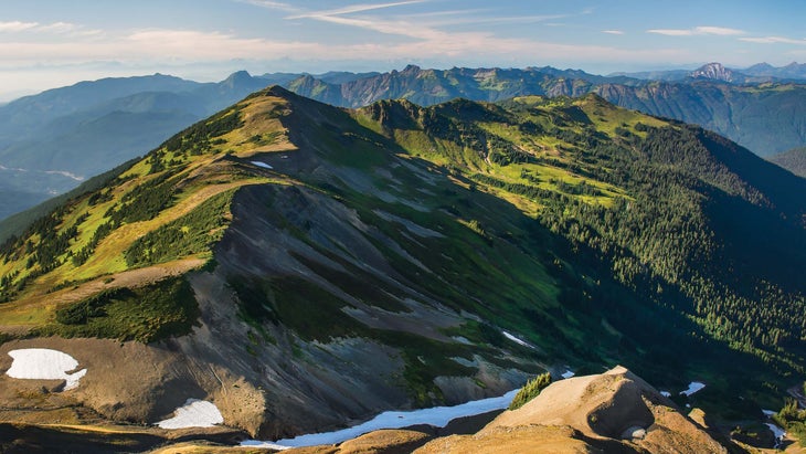
A gentle summer wind sweeps the heather on Skyline Divide, rippling the delicate pink and white flowers in a wave across the ridgeline. With no trees to block the view, Mt. Baker’s enormous cone dominates the southern skyline, seeming to rise straight from the meadows of the divide. To the west, Mt. Shuksan’s glaciers throw back the evening light in dazzling gold; between both peaks and all around, the North Cascades raise spiky, ice-carved ridges to the sky. From just outside my tent I take in the view as my stove roars to life beside me, the loudest thing in earshot besides a pair of ravens down the hill. I only have to take a step or two to pick my views: Volcanoes or river valleys? Glaciated peaks or wildflower-strewn meadows?
Skyline Divide is one of my favorite hikes—and it could be one of yours, too. You can spend days meandering up the branching ridgelines of the divide, finding new panoramas and hidden snowfields around every corner. Seattle may only be an hour away, but the city is only a faint glow on the horizon here, and the wilderness stretches all around.
The Trail
;
After leaving Mt. Baker Highway on FS road 39 just past the town of Glacier, the road to Skyline Divide gets bumpy: Take a left on FR 37 for just under 13 miles of dirt road, often with large potholes and washboard sections. Two-wheel-drive cars can make the trip, but it may get dicey. From the trailhead, climb 2 miles and 1,500 feet to the ridgeline through a forest of mixed hemlock and silver fir. Pass treeline and continue onto the ridgetop, then continue tracing the 6,000-foot crest over six knolls and 2.5 more miles. Smaller trails branching off from the ridgeline lead towards spurs or campsites; spend a weekend on Skyline to explore them all. The trail is popular during summer months and reservations aren’t available (permits aren’t required, either), so plan to head up on a weekday for an overnight stay. Only camp in established sites: Even though the meadows are mostly flat and look like a great spot for a tent, they are fragile, and your one-night backpacking trip could set the alpine plant growth back years. —Kristin Smith
 Photo: “Mt Baker from Skyline Divide” by jaisril is licensed under CC BY 2.0
Pack it in
Though stock is only allowed on the Skyline Divide Trail from July to October, llamas are permitted year-round. These pack animals are nimble in mountain terrain, easygoing, and can carry up to a third of their weight in gear. They eat and drink much less than horses or mules, leaving more room in their packs for your gear, and their long necks work as a counterbalance when carrying a load. LNT bonus, the soft pads on llamas’ feet cause even less damage than hikers.
Rocky Peak Ridge, Giant Mountain Wilderness, NY
- Distance: 13 miles
- Time: 1-2 days
- Elevation gain: 4,558 feet
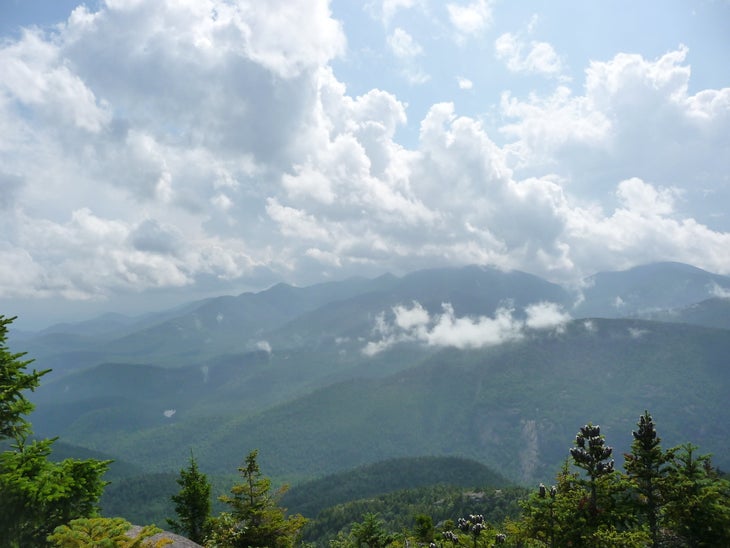
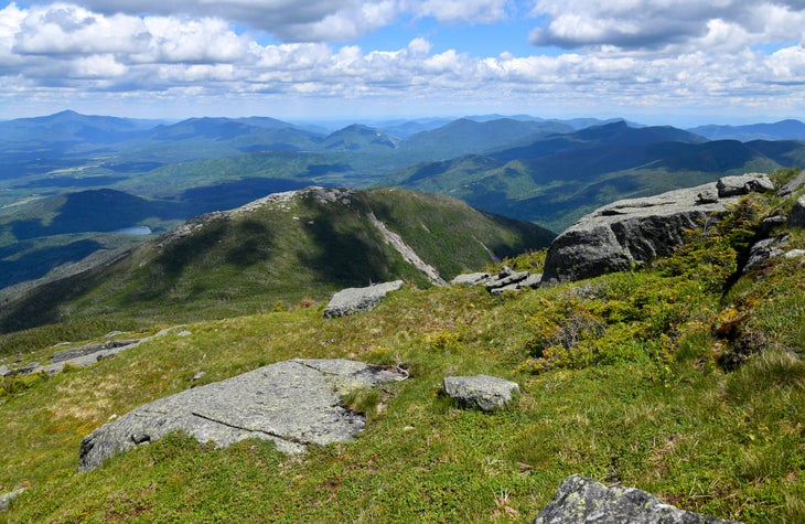
Almost 5,000 feet of elevation gain keeps the crowds away from this Adirondack summit, but the burn is worth it: the trail winds up and over several smaller peaks before reaching 360-degree summit views of the surrounding mountains. Rocky slabs along exposed portions of the ridgeline add a scrambly feel to the trek. At 4,420 feet, Rocky Peak is only the 20th highest mountain in the Adirondacks, but the trail up the ridge is widely considered one of the most scenic in the range; the crest’s exposure means unobstructed views of the surrounding valleys and the peaks rising opposite. By winding up and over several smaller summits on the way to the trail’s high point, this hike actually gains more vertical feet than the summit elevation. Fuel up just out of the parking lot with a short climb through the aptly-named Blueberry Cobbles, a hill that in late summer is filled with wild fruit.
Though the 13-mile round-trip is doable in a day, you don’t have to rush: There’s a campsite at Mary Louise Pond at mile 6.1. Pitch your tent by the water for a night of recovery before continuing the push to the summit, then head all the way down the next day.
The Trail
From the Trailhead on the west side of US 9, follow the East Trail west and south until it meets a drainage and snakes back around the west side of a knob before climbing to Blueberry Cobbles. At mile 2, a trail branches off right that bypasses Blueberry Cobbles. Head left to crest the Cobbles and get your first views to the south. The side trail rejoins at mile 2.5, head left. The first rocky sections appear just before Mason Mountain at mile 2.9. From here, climb steeply toward Bald Peak, where the rocky ridgeline opens up in earnest. Hit the top at mile 3.8. Climb up the ridgeline and descend to Mary Louise Pond at mile 5.9. Spend a night at the designated campsite here. The next morning (or the same day, with a lighter pack), continue west on the East Trail to the summit of Rocky Peak Ridge (4,420 feet) at mile 6.5. Retrace your steps east back to camp and eventually the parking lot at mile 13.2 (assuming you take the side trail to avoid the Blueberry Cobbles on your return).—Directions by Ryan Wichelns
Camp in the Clouds
The Mary Louise Pond campsite is one of the highest in the Adirondacks, and one of very few close to a summit, too. In the summer, sleeping above 4,000 feet outside a designated campsite isn’t allowed in these mountains, and with very few sites near that elevation, this is one of the only spots to try. Bonus: It’s barely half a mile to the summit from here, so you can even take your morning coffee with you for a sunrise summit bid.
Specimen Ridge, Yellowstone National Park, WY
- Distance: 17 miles
- Time: 1-2 days
- Elevation gain: 4,012 feet
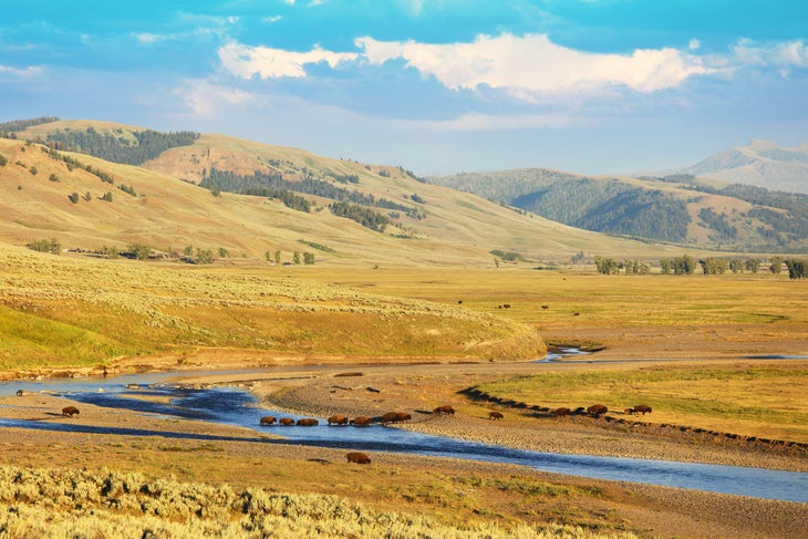
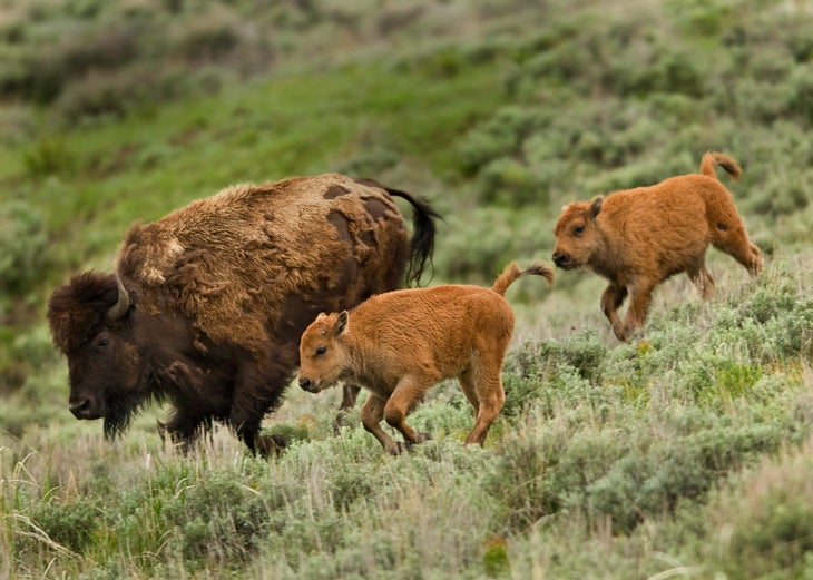
The Lamar Valley is also known as “America’s Serengeti” for a reason: It’s absolutely full of wildlife. Bison, pronghorn, wolves, grizzlies, black bears—if it’s a species of charismatic megafauna native to North America, it lives here. Hike through the herbivore herds, then watch from above on this point-to-point traverse of Specimen Ridge at the edge of the valley. The trail climbs through rolling, grassy hills, dotted with occasional stands of pine, before topping out on 9,164-foot Amethyst Mountain. Beyond the wildlife on the grasslands below (or sometimes on the trail), the views from the summit stretch to the peaks of the Gallatin and Absaroka ranges, with high points of 10,969 feet and 13,153 feet, respectively. Summer often brings bighorn sheep to the slopes of the ridgeline, while bison prefer the plains below. Hikers can spot wolves any time of year (the territories of three different Yellowstone packs are wholly or partially in the Lamar Valley), though winter often has the most sightings.
Though Yellowstone draws tourist crowds in the summer months, you won’t find any traffic jams on this hike. The distance, plus its location in the park’s far northeastern corner, keeps it from being overrun. You’re more likely to encounter wildlife on the trail than large groups of hikers. If you do encounter animals, make sure to give them plenty of room, and always carry bear spray.
The Trail
From the trailhead, hike southeast across the vast, rolling hills that border the eastern edge of the Grand Canyon of the Yellowstone. After 1.4 miles, the trail veers to the right below the crest of Specimen Ridge and continues to climb to the southeast. Roughly 2 miles later, take a break at scenic vantage point overlooking Yellowstone’s wildlife-rich northern range.
The route tops out on 9,614-foot Amethyst Mountain after 10 miles, giving way to some of the best panoramic views Yellowstone has to offer. From here, the trail drops down Amethyst’s southeast ridge, then swings to the northeast into the Lamar Valley. At mile 15.6, ford the Lamar River, then continue a 2-mile descent to the route’s end point at the Lamar River Trailhead.
Note: Before you hike this trail, check with park rangers to determine the levels of the Lamar River.
—Backpacker Magazine/Mapped by Jason Kaufmann
America’s “Antelope”
If you know the song “Home on the Range,” you’ve probably heard the line “oh give me a home/where the antelope roam,” and wondered what this singing cowboy was talking about. After all, antelope are native to Africa and Asia, not the Americas. It turns out that Brewster M. Higley, the song’s lyricist, probably had a very different animal in mind: the pronghorn.
Yellowstone’s pronghorn aren’t actually part of the antelope, goat, or deer families, though they bear similarities to all of them. In fact, the pronghorn is the last surviving member of the Antilocapridae family, and it originated in North America over a million years ago. Their closest living relatives are the giraffes of Africa. Pronghorn are active both during the day and during the night, can spot a threat up to four miles away, and, with a top speed of 60 mph, are the fastest land animals in the entire Western Hemisphere.
Parnell Esker, Kettle Moraine State Forest, WI
- Distance: 9 miles
- Time: 1 day
- Elevation gain: 524 feet
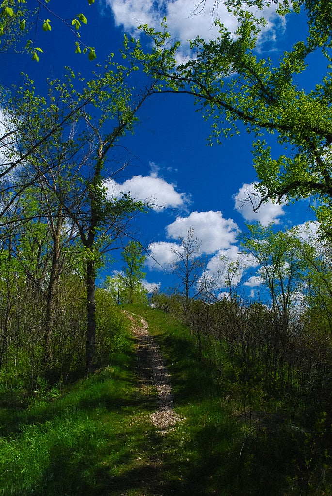
Unlike some of the grander ridges on our list, you probably wouldn’t be able to spot this rolling ridge from a plane. Parnell Esker is roughly 4 miles long and only rises between 5 and 35 feet high as it winds through quiet woods and past 7-acre Butler Lake, climbing and descending the rolling hills of Wisconsin’s picturesque Kettle Moraine State Forest. But this unassuming ridgeline is hiding an intense geologic history.
Parnell Esker formed during the last Ice Age, which ended roughly 11,000 years ago, when a series of massive ice sheets shaped the soil and stone of the Midwest before melting away under the strain of rising temperatures. But their legacy remains: This particular esker (a ridged geologic feature formed in the hollow where a stream flowed underneath a glacier) is now one of the most notable sights along the 1,200-mile Ice Age National Scenic Trail, which wends through Wisconsin from Interstate State Park on the Minnesota border to the shores of Lake Michigan. Hikers who tackle this daylong trek can sightsee features uncovered by the glaciers’ retreat, like conelike kames, hills formed from sediments that collected in depressions on melting glaciers.
The Trail
This 9-mile out-and-back begins at the parking area for Butler Lake and dead-ends at an observation tower, which makes a good turnaround point for a day of exploration. From the trailhead, the path skirts Butler Lake and heads around a bog. After crossing Highway V, the trail begins its roller coaster ride along the spine of the esker, passing into a dense forest with stands of sugar maple and red oak. At mile 4, take a right onto the Parnell Tower Trail and follow it to the 60-foot observation tower, where you can enjoy views of 1,361-foot Holy Hill. Retrace your steps to the trailhead.
Ice Age Trail
Parnell Esker is just one small segment of the Ice Age Trail, and motivated hikers can find anything from a season-long trek to a satisfying overnight along it. To see more, turn this dayhike into a 13.6-mile, point-to-point overnight by starting further south, at Mauthe Lake Recreation Area and skirting Forest Lake and Crooked Lake and the diminutive Kellings Lakes before reaching the spur trail to Backpacking Shelter Number 3 at mile 5.3. In the morning, head north to Parnell Tower, then continue on through progressively less-hilly forest (keep your eyes peeled for red foxes and Cooper’s hawks) until you reach the section’s terminus—and your pick-up—on State Highway 67. Want to go further—like, way further? A thru-hike of the entire trail takes average hikers between 2 and 3 months, though the standing record is just 22 days.
Ridgeline Trail, Prehistoric Trackways National Monument, NM

- Distance: 2 miles
- Time: Half-day
- Elevation gain: 572 feet
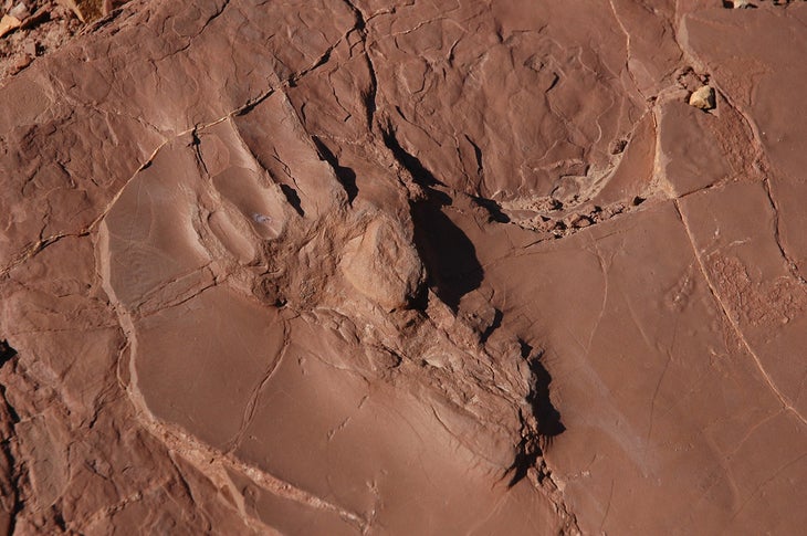
When you set out for a hike on this trail in the high desert of New Mexico’s far south, you’re following a historic path. Prehistoric, actually: This monument preserves fossilized tracks from a wide variety of Paleozoic animals, ranging from diminutive creatures like gastropods and amphibians to the toothy, fan-backed proto-dinosaurs Dimetrodon and Edaphosaurus . (While some of the fossils are still visible in the park, many have been excavated and are preserved in museums in nearby Las Cruces and around the US.) The monument itself is relatively new, dating back to just 2009, when then-President Obama designated it by proclamation.
Fossils or no fossils, this desert path shows off the sweeping vistas and sometimes-harsh beauty that makes hiking in the desert such a memorable experience. There are few tourists here and fewer facilities—no visitor center or gift shops in this national monument. Instead, you’ll wend your way through arroyos and patches of spiky desert plants like ocotillo, agave, and yucca on your way to a desert peak with views of the Dona Ana and San Andres Mountains.
The Trail
The Ridgeline Trail is more or less the only established hiking in Prehistoric Trackways,. It’s well-marked, so as long as you don’t stray from it, finding your way won’t be much of a challenge. From the lower parking lot on Permian Road, follow the trail through open scrubland and past dry creek beds (keep an eye out for rattlesnakes in the area.) After about a half-mile, the trail begins to steepen, climbing gradually to the broad top of a mountain where you can soak in views of the Rio Grande below. Retrace your steps or continue on to link the Ridgeline Trail to the Discovery Trail for a 3-mile lollipop loop.
Ancient History
You might not be able to tell from looking at it today, but New Mexico wasn’t always such an arid landscape. Until about 70 million years ago, the eastern and southern parts of the state, including Prehistoric Trackways, were covered by what paleontologists now call the Western Interior Seaway, a shallow, warm sea that was home to everything from long-necked plesiosaurs to giant sharks to ancestors of today’s mussels and clams. Today, fossils from some of these creatures are regular finds around New Mexico. Other notable species first discovered in the state include Alamosaurus, the largest dinosaur ever discovered in the United States, and the state fossil Coelophysis, a diminutive raptor that weighed about 40 pounds.
Heat
Like other desert destinations, Prehistoric Trackways can be challenging in the summer: There’s little shade and less reliable water, and the monument’s rugged backcountry character means that if you do get into trouble, you may not be able to easily summon help even on hikes that are relatively close to the trailhead. Make sure you’re carrying enough water—at least a gallon per person per day—cover up to reduce moisture loss from evaporation, and consider postponing your hike or hiking near dawn or dusk if temperatures climb dangerously high.
East Ridge, Quandary Peak, White River National Forest, CO
- Distance: 6.7 miles
- Time: 1 day
- Elevation gain: 3,253 feet
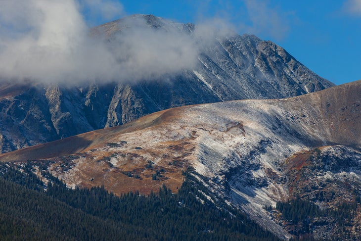
The 14ers are Colorado’s jewels and Quandary is one of the most beautiful, its broad, snow-streaked pyramid rising high above the Tenmile Range. Unfortunately, we’re not the only ones who think so: As of 2020, Quandary is the most popular 14er in Colorado, drawing an incredible 50,000 hikers from around the state and beyond. If you’re doing the math, that’s an average of 136 people per day (and far more during the summer, when conditions are ideal.) On the busiest mornings, the trail to the top looks more like a conga line than a hike.
So should you steer clear? We don’t think so. Hiking up Quandary’s East Ridge—the classic route to the summit—is like climbing a catwalk into the sky, a broad ridgeline that treats climbers to the snow-capped peaks surrounding Breckenridge the entire way up. The best part? This is one of the easiest 14ers to climb, not counting drive-ups like Pike’s Peak or Mt. Evans, making it an ideal place to start your journey up the state’s highest summits.
The Trail
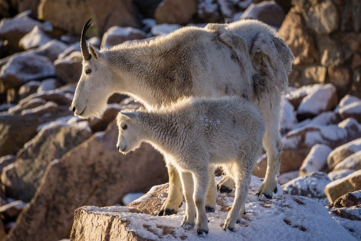
The 6.7-mile out-and-back trip starts at the Quandary Trailhead. From the lot, follow the path as it steadily climbs the ridge through thinning trees, eventually erupting out onto a broad shoulder below the ridgeline. (Keep an eye out for herds of mountain goats, which like to congregate here.) About a mile in, the slope steepens substantially, climbing up the rocky ridge, before reaching another wide shoulder at mile 1.3. Catch your breath and make the final push up to the wide summit, where you’ll bask in views of the Mosquito and Gore Ranges before turning around for the downhill.
Reservations
Crowds are always inconvenient, but sometimes they can pose a genuine danger. That’s what happened on Quandary, where the glut of visitors often fills parking lots by the wee hours of the morning and has led some people to park illegally along the roadside, potentially delaying emergency response when hikers get in trouble. The government of Summit County, where the peak is located, responded by instituting a reservation-only parking system. The fees, which begin on July 30, 2021, are astronomical, peaking at $50 for an all-day pass. A cheaper alternative? Take the shuttle bus, which leaves from Breckenridge’s Airport Road parking lot.
Winter Hikes
Colorado’s 14ers are just as spectacular in winter, if not more, but avalanche danger and harsh weather keep all but a relatively few hardy hikers from heading for the peak. If you have a good grasp of avalanche safety, a calm weather forecast, and a reasonable tolerance for the cold, Quandary is among the easier 14ers to summit in the snowy season, since the easy-to-follow ridge keeps visitors away from slide-prone slopes. Bonus: Pack skis and avalanche gear for the ride down, which is mellow enough for less-experienced backcountry skiers to tackle in good conditions.
Boulder Ridge Trail, Mt. Hood National Forest, OR
- Distance: 5.3 miles
- Time: 1 day
- Elevation gain: 2,294
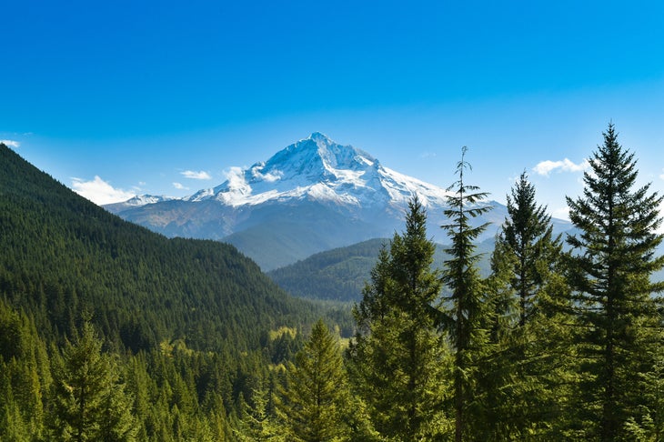
This climb from moss-draped forest waterfalls to ridgetop views of Mt. Hood and the Salmon River Valley is tough, but worth it. The out-and-back is close enough to Portland to make an easy day’s escape from the city (or, for particularly speedy hikers, even a weekday morning). The path winds through some of the best the Pacific Northwest has to offer: Hikers start in thick valley forest, where evergreens sway over wildflowers on the forest floor. The highlight of this section is the multiple stream crossings and accompanying miniature waterfalls, trickling down thick cushions of bright green moss at the trailside. From the forest, the climb heads quickly upward, with occasional glimpses of Mt. Hood between the trees. At the top, though, you’ll get more than a glimpse: The whole of the Salmon River Valley and the volcano opposite spread out beneath the trail, and on a clear day Mt. St. Helens is visible to the far north.
It’s not just the stratovolcano views and pleasant path that draw hikers here from the coastal cities, though. With a moderate grade and a relatively short round-trip distance, this hike is easy enough for kids, dogs, and new-to-hiking friends, with plenty of rewards for their efforts.
The Trail
Start from the BLM-managed Wildwood Recreation Site. Follow signs just under a mile to the Wetlands Boardwalk Trail, then ollow the Boardwalk Trail across the Salmon River, .5 mile from the trailhead, where the Boulder Ridge Trail starts. The first stretch of trail is flat, crossing damp terrain near the river, but the climb soon begins. The grade stays moderate throughout, but scattered viewpoints of Mt. Hood make good rest points or snack stops when needed. These viewpoints are also great turnaround spots for those looking for a shorter hike. Climb 2.7 miles and 2,294 vertical feet to the ridgeline, where the Plaza Trail offers an optional continuation for those who want to head deeper into the Salmon-Huckleberry Wilderness.
The Salmon of Salmon River
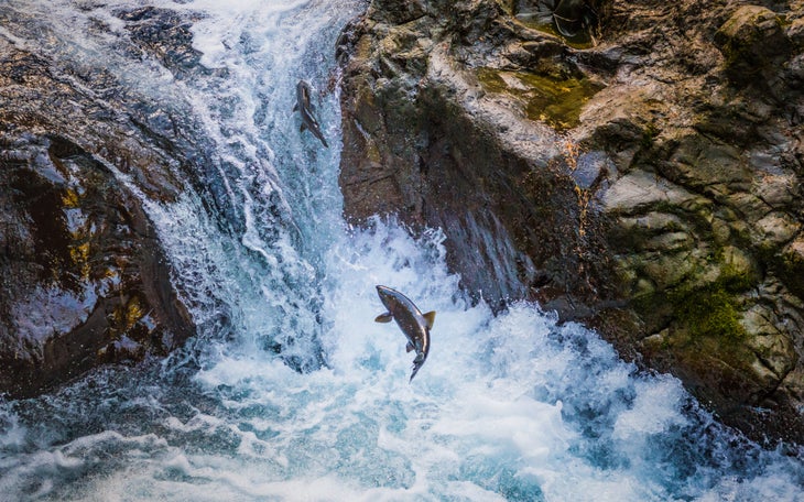
The Salmon River is a recognized Wild and Scenic River from its headwaters to where it meets the Sandy River over 30 miles later. Part of this status comes from its importance as a spawning ground for salmon and steelhead. Chinook and Coho both spawn in the upper reaches of the river, leaping upward past several waterfalls as they swim against the current every year. Steelhead—oceangoing trout—also spawn in the area, which is key habitat for their local population
Marshall Ridge Trail, Sawtooth Mountains, ID
- Distance: 4 miles
- Time: 1 day
- Elevation gain: 810 feet
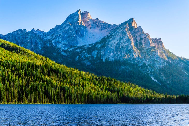
This short but sweet trail reaches expansive Sawtooth views in just a couple miles. From aspen forest, the trail climbs quickly to the eponymous ridge, coming out above Marshall Lake, which you can reach from a spur trail farther down the ridge. On the crest, grasses and sagebrush catch the wind in waves of gold and silver-green; below aspen stands do the same, the pale undersides of each leaf catching the sunlight. You won’t stay focused on these near-trail beauties for long, though, with the crest of the Sawtooth Range looping across the opposite side of a broad forested valley to come up behind Marshall Ridge itself. The spiky peaks often hold snow late into the summer, serving as a reservoir to the region’s many trout-filled streams and lakes.
The path might not be long, but you’ll want to linger at the top: Pack lunch (or dinner, or breakfast) and a blanket and spend a while beneath Heyburn, Hortsmann, and Thompson peaks. Want to extend your trip to the mountains? Continue up the ridgeline to meet up with trails to Marshall Lake and Thompson Peak, the high point of the Sawtooths at 10,751 feet.
The Trail
Start at the Fishhook Creek Trailhead, near Redfish Lake. Follow the Fishhook Creek Trail to a fork only a few hundred feet from the parking lot, then continue straight. At mile .5 take a right at another fork onto the Marshall Ridge Trail. The climb starts mellow and increases to moderate as the path climbs through wildflower meadows and aspen groves. Emerge on the crest of the ridge at mile 2. The climb ends here, with nothing left to do but take in the mountainous panorama.
A Flower With Some Fuzz
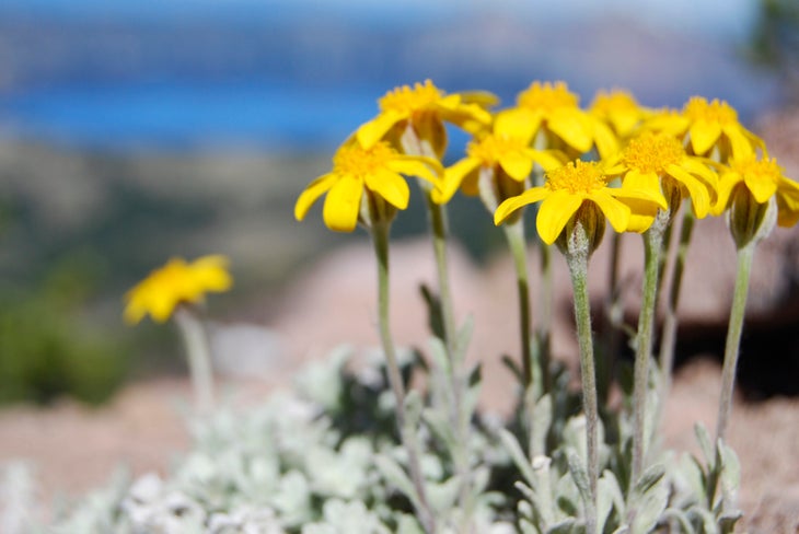
If you’re heading into the Idaho mountains in spring or summer, you’ll probably spot some cheerful yellow blooms in meadows and on rocky slopes. A lot of those are woolly sunflowers, also known as Oregon sunshine. These wildflowers prefer dry, open spaces. They can grow up to 2 feet tall, with flowers up to 2 inches across. As for the name? Each plant has white, “woolly” hairs covering the leaf surface, which reduce water loss by reflecting heat and limiting air movement across the actual surface of the leaf.
