Products You May Like
Get full access to Outside Learn, our online education hub featuring in-depth fitness, nutrition, and adventure courses and more than 2,000 instructional videos when you sign up for Outside+
Sign up for Outside+ today.
What do we love so much about hiking in Washington? Basically, it has everything a hiker could want: From long strolls along beaches and misty forests to awe-inspiring summits and wildflower meadows, there’s a huge variety of hikes for every person in Washington. We’ve rounded up the best of the best to take the guesswork out of finding your route.
Best Dayhikes In Washington
If you’re looking for a short hike with big rewards, there are many dayhikes around Washington that fit the bill. Check out waterfalls, mountaintop lookouts and more on these routes.
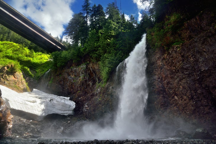
Best Waterfall: Franklin Falls
Length: 2 miles
Elevation Gain: 400 feet
Trail Type: Out and back
Difficulty: Easy
It isn’t exactly wilderness: This iconic waterfall is situated between the eastbound and westbound lanes of I-90, but the sound of the water easily drowns out any highway noise. On the short one-mile trail, you’ll weave through a thick coniferous forest along the Snoqualmie River. As you approach the end, you’ll start to hear the roaring sound of Franklin Falls beckoning you. Once you’re by the base of the falls, you can explore around the river rocks and get that perfect camera angle on the three-tiered, 135-foot cascade. For a variation on the way back, take the quieter Wagon Road Trail, which adds less than a quarter mile to the trip. In the winter, the waterfall freezes over to create beautiful ice, but you’ll need to brave an additional 2 miles of road closure each way.
Check out the route on Gaia GPS here.
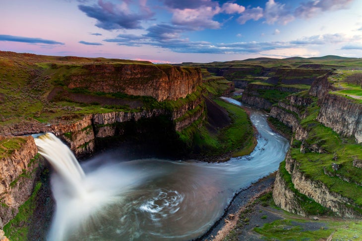
Best ADA Accessible Trail: Palouse Falls
Length: 1 mile
Elevation Gain: 300 ft
Trail Type: Out and back
Difficulty: Easy
Unlike the abundant waterfalls of the state’s thickly forested western slopes, Palouse Falls is uniquely situated in Eastern Washington, where trees are far and few between but canyons are plentiful. The gorge that holds the cascade was carved by ancient glacial flooding, and the falls themselves are currently the official state waterfall, with a dramatic 198-foot drop sure to impress. Although it is in the drier part of the state, the ledges surrounding Palouse Falls are abundant with greenery. In the spring, you might even see wildflowers like lupine and balsamroot. There’s a few viewpoints you can check out that are easily ADA accessible: The main overlook, just 0.1 miles from the parking area, gets you front and center of the waterfall. Pro tip: Get there at sunrise or sunset for epic lighting of the whole gorge.
Check out the route on Gaia GPS here.
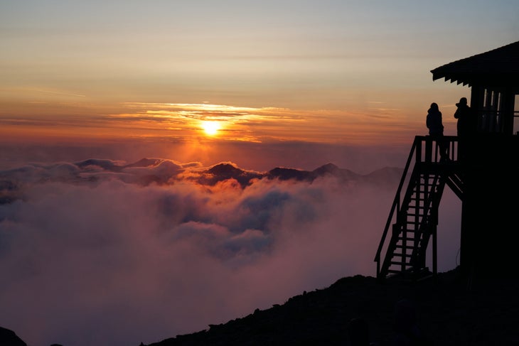
Best Lookout: Fremont Lookout
Length: 5.6 miles
Elevation Gain: 1,200 ft
Trail Type: Out and back
Difficulty: Moderate
Among all the lookouts in the Cascades, Fremont Lookout has the best view of Mt. Rainier, with its perfect volcanic silhouette and streaks of glaciers running down the sides into luscious green meadows. As you hike up to the lookout, you’ll pass through gorgeous fields of wildflowers and stands of evergreens. Bonus: from this perch, you can watch both the rising and setting sun light up Rainier in the summer.
Check out the route on Gaia GPS here.
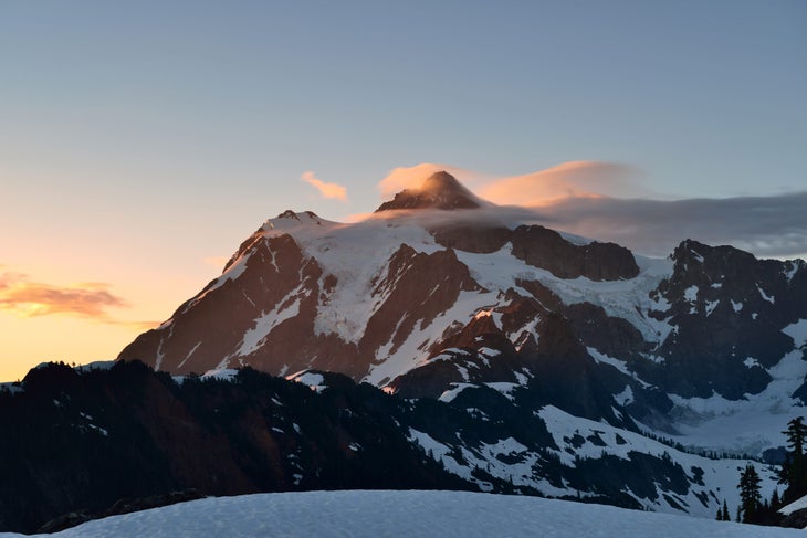
Best Trail to Watch the Sunset: Huntoon Point
Length: 1.2 miles
Elevation Gain: 200 ft
Trail Type: Out and back
Difficulty: Easy
A short out-and-back from Artist Point, this hike has incredible views of glacier-hung Mt. Shuksan at sunset. Whether or not you’re into photography, watching the alpenglow on the mountain’s snowy flanks is sure to impress, especially when you can see the peak in its entirety; Mt. Shuksan looks more like a piece of the Himalayas than a northwest mountain. This is also a great snowshoe hike in the winter, although you’ll add a little more distance to reach it from the Heather Meadows parking lot. For a longer summer hike, wrap around Table Mountain on the Chain Lakes Loop to enjoy some alpine lakes and views of Mt. Baker before settling in for the show.
Check out the route on Gaia GPS here.
Best Wildflower Meadow: Iron Bear to Teanaway Ridge
Length: 6.5 miles
Elevation Gain: 1,900 ft
Trail Type: Out and back
Difficulty: Moderate
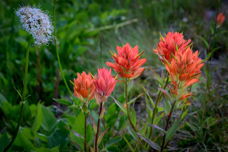
Teanaway Ridge has some of the best wildflowers in Washington, blooming much earlier than its subalpine counterparts. The Iron Bear trail leads you to fields upon fields of wildflowers ranging from lupine to balsamroot and penstemon. Yellows, purples, pinks, and all the colors of the rainbow abound here amongst the dry dirt. As a bonus, you’ll get a sweet view of the Stuart Range; the other side of the peaks is the famed Enchantments. Add some extra distance with a summit of Iron Bear Peak, a short jaunt away, or keep exploring the many miles of Teanaway Ridge to your heart’s content.
Check out the route on Gaia GPS here.
Best Winter Snowshoe: Hex Mountain
Length: 7 miles
Elevation Gain: 2600 ft
Trail Type: Out and back
Difficulty: Moderate
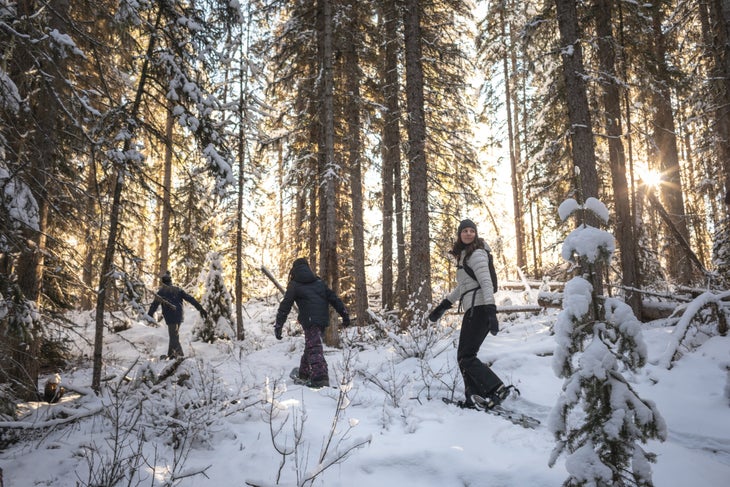
In the winter, many of Washington’s popular summer trails are risky due to avalanches. Hex Mountain is an exception. The ridgeline path makes an excellent snowshoe destination, minimizing risk while maximizing panoramic views. It’s a relatively well-traveled winter hike, and you can often follow older footprints to make your way along the ridge. On a clear day, you might even see Mt. Rainier in the distance. More experienced hikers can make a lollipop loop around the eastern ridge of the mountain back to the main trail.
Check out the route on Gaia GPS here.
Best Island Views: Mt. Constitution
Length: 6.7 miles
Elevation Gain: 1,500 ft
Trail Type: Loop
Difficulty: Moderate
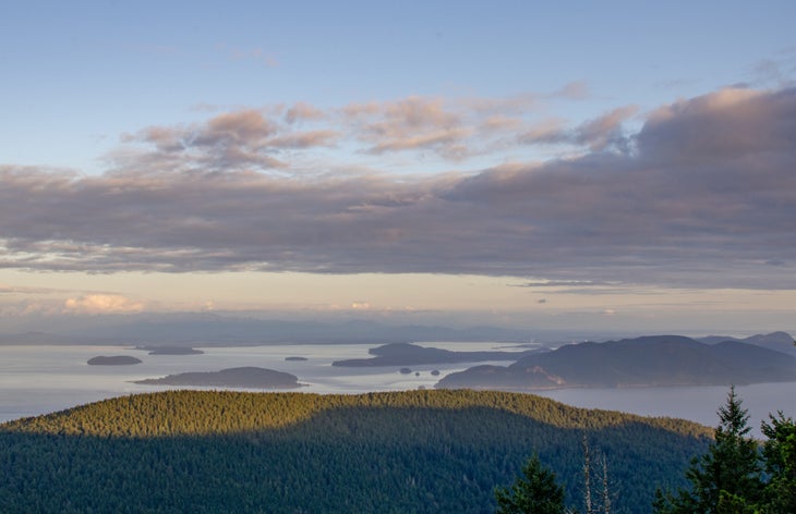
There are over 170 islands in the San Juan Islands archipelago, accessible only by plane or boat. Take the ferry from Anacortes to Orcas Island, home to Moran State Park, which offers many campgrounds and miles of trail. The highlight of the park is Mt. Constitution, the highest point in the islands at 2,399 feet. Although you can drive to the top, it’s much more fun to hike up through the forest from Mountain Lake. Take the loop clockwise for a gentler elevation gain and a nice lake-side stroll at the end of the hike. At the summit, climb up the stone tower to get a better view of Puget Sound, the surrounding islands, and even the coastal ranges of Canada.
Check out the route on Gaia GPS here.
Best Underground Adventure: Ape Caves
Length: 2.8 miles
Elevation Gain: 350 ft
Trail Type: Loop
Difficulty: Easy
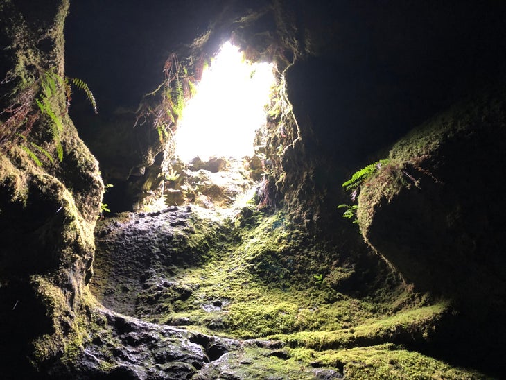
If what you’re looking for is a unique hike, head over to Ape Caves by Mt. St. Helens. The cave is the third longest lava tube in North America and consists of a Lower Cave and Upper Cave. Equip yourself with a good source of lighting (and a backup) before entering the lava tubes. The Lower Cave is easily accessible and wide open, while the Upper Cave is more technical, requiring more agility to maneuver around the big rock piles. At times, the upper section will require tight squeezes and walking under low ceilings. The ladder exit out of the upper cave brings you back to a hike in the woods for an easy loop back to the car. The Lower Cave is simply an out-and-back path. Be sure to check out both areas if you are feeling brave, but remember not to touch the “slime” on the walls of the cave: it’s an important and delicate part of the cave ecosystem. Permits are required from April to October.
Check out the route on Gaia GPS here.
Best Sunrise Hike: Mt. Ellinor
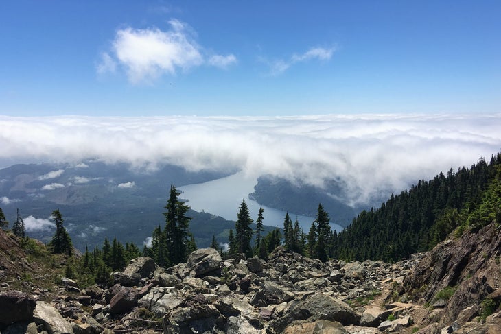
Length: 6.2 miles
Elevation Gain: 3,300 ft
Trail Type: Out and back
Difficulty: Difficult
The sweeping views of both the Cascades and Olympics make this the perfect sunrise hike. If you’re looking for a shortcut, starting at the upper trailhead cuts just over a mile each way from the hike. For either starting point, you’ll begin with a lovely climb in the forest. The steep trail rewards hikers with panoramic views that overcome any pain from the hard uphill, looking out over the best of all the mountains in the state. At the summit, pause, and see how many of the toothy peaks lining the horizon you can name. This hike is well traveled in both winter and summer months, although more expertise will be required for snow travel.
Check out the route on Gaia GPS here.
Best Hike In Mount Rainier National Park: Skyline Trail
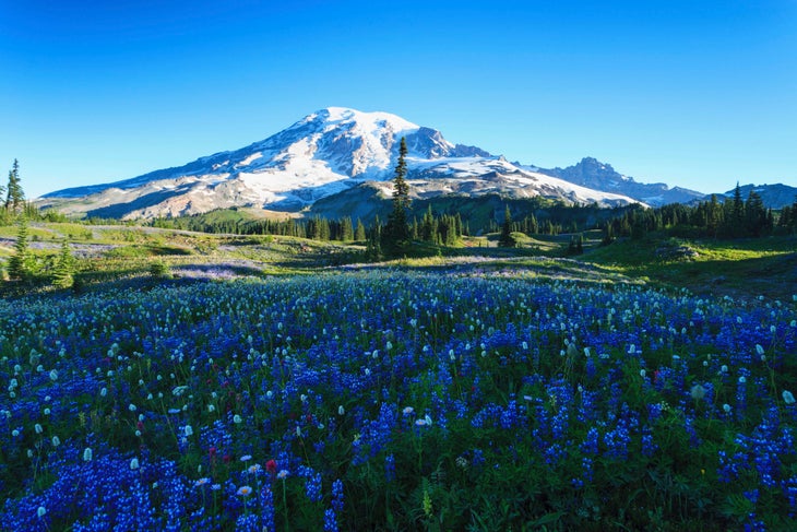
Length: 5.5 miles
Elevation Gain: 1,450 ft
Trail Type: Loop
Difficulty: Moderate
There’s a good reason why Paradise got its name. Whether you’re an avid hiker or just a tourist for a day, the views at Paradise are sure to impress. The Skyline Trail weaves around wildflower meadows before serving up views of the Tatoosh Range and Mt. Rainier itself. Strong hikers may choose to continue up to Camp Muir, where many experienced mountaineers start their route to Rainier’s summit.
Check out the route on Gaia GPS here.
Best Weekend Hikes In Washington
Ready to spend a whole weekend outside? These trails will take you to some of the best backcountry sites anywhere.
Best Golden Larch Hike: Lake Ingalls
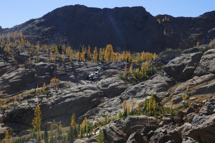
Length: 9 miles
Elevation Gain: 2,500 ft
Trail Type: Out and back
Difficulty: Moderate
This is easily one of the most popular trails when the larches—one of the world’s only deciduous conifers–begin to turn. From the Esmeralda Basin Trailhead, you first climb towards Longs Pass. As you leave behind the pine trees, the surrounding views open up and golden larches will start teasing you as you make your way over to the next basin. Stay high for clear views of Mt. Stuart while traversing the trees, then continue onwards to the Lake Ingalls basin, where you’ll pass some rockier terrain and easy scrambling. At the lake, scramble a short way to view the iconic reflection of Mt. Stuart on the lake. You’ll find more golden larches on the other side of the valley. Note that while you cannot camp by Lake Ingalls, camping is allowed in Headlight Basin, prior to reaching the lake.
Check out the route on Gaia GPS here.
Best Hike for Autumn Colors: Little Giant Pass
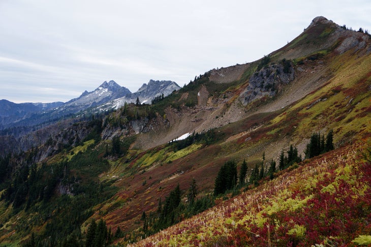
Length: 10 miles
Elevation Gain: 4,000 ft
Trail Type: Out and back
Difficulty: Difficult
The trails surrounding Glacier Peak host some of the most vibrant colors in fall. Little Giant Pass is the most exceptional among these, rambling from the Chiwawa Valley into the Napeequa Valley. The adventure begins by crossing a low river ford to pick up the forest trail. As you take the switchbacks up, the meadows and colors begin. Vibrant red streaks on the hillsides reveal themselves to be wild blueberry and huckleberry leaves that have turned from their summer green to autumnal vermillion. (Don’t forget to take time to pick some wild berries to eat.) At the pass, the Napeequa Valley opens up to astounding hillsides of crimson and gold fall foliage. Soak it all in or keep wandering into the valley, where you can foraging wildlife as excited about the fall berry harvest as you are.
Check out the route on Gaia GPS here.
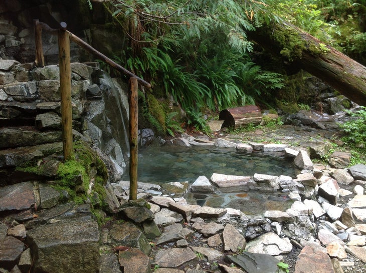
Best Hot Springs: Goldmyer Hot Springs
Length: 11 miles
Elevation Gain: 1,010 ft
Trail Type: Out and back
Difficulty: Moderate
Your experience on this hike may depend on whether you own a Jeep or not: high-clearance and off-road vehicles can drive to the Dingford Trailhead, located within 1 mile of the springs. Have a normal car? You’re looking at an 11-mile hike. From the Garfield Ledges Trailhead, you can either hike or bike the forest road instead of driving it up to Dingford, where the road becomes a gentle hiking trail with lovely overgrown grass next to the Middle Fork Snoqualmie River. Continue up to the springs themselves, a geothermal haven where you can also camp overnight, reservations permitting. Whether in the summer or winter, the sheltered forest pools are a lovely place for a soak. Reservations are required year round to use the hot springs.
Check out the route on Gaia GPS here.
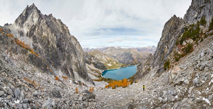
Best Weekend Point-to-Point: Enchantments
Length: 18 miles
Elevation Gain: 4,500 feet
Trail Type: Point to point
Difficulty: Strenuous
There seems to always be a disagreement for how long the Enchantments hike is. But one thing everyone agrees on: it’s worth the distance, and then some. Starting from the Stuart Lake Trailhead, the path heads into evergreen forest. You’ll soon break off and begin climbing to Colchuck Lake. This lake itself is beautiful enough, with its aquamarine, crystal-clear waters. But continue up the steep Aasgard Pass, and you’ll be rewarded with views of carved-granite peaks similar to the Eastern Sierras. As you descend down towards Snow Lake, you’ll find yourself exploring the “core” region, dotted with over 700 alpine lakes. Overnight permits are difficult to get; if you miss out you can do this as a long day hike, and spend the second day of your weekend recovering. If you have more energy left, consider scrambling some of the nearby peaks, such as Little Annapurna.
Check out the route on Gaia GPS here.
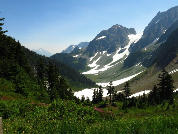
Best North Cascades National Park Hike: Cascade Pass
Length: 7 miles
Elevation Gain: 1,800 ft
Trail Type: Out and back
Difficulty: Moderate
One of the crown jewels of the North Cascades, Cascades Pass offers a bit of everything, checking all the boxes for forest, wildflowers, glaciers, and high peaks. (The flip side: Plan far in advance to get your permit, as this is a popular spot. Many mountaineers come here before continuing their journey on the Ptarmigan Traverse or climbing Sahale Peak. Whatever time of year you come, you’re sure to enjoy stunning views from impressive peaks to colorful hillsides marked by lupine and blueberry bushes.
Check out the route on Gaia GPS here.
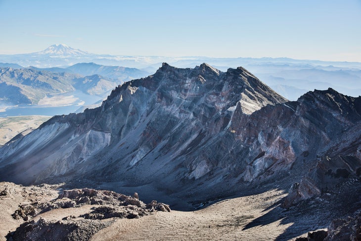
Best Summit Hike: Mount St. Helens
Length: 10 miles
Elevation Gain: 4,500 ft
Trail Type: Out and back
Difficulty: Strenuous
Not for the faint of heart, Mount St. Helens is a great peakbagging trip for the adventurous hiker. This volcano is only hikeable for the short summer months, and the path up consists of loose rocks through the boulder field. The rest of the year, it is snow covered, requiring legitimate mountaineering skills and a longer trek due to the upper trailhead closure. While challenging, hiking Mount St. Helens is also incredibly rewarding, especially on a clear day; To the north, peer into the exposed crater, then further towards Spirit Lake below and a backdrop of Mt Rainier. You might also see Mt Adams, Mt Hood and a few other Oregon volcanoes nearby on especially sunny days. Permits required April-October.
Check out the route on Gaia GPS here.
Best Scramble: Kaleetan Peak
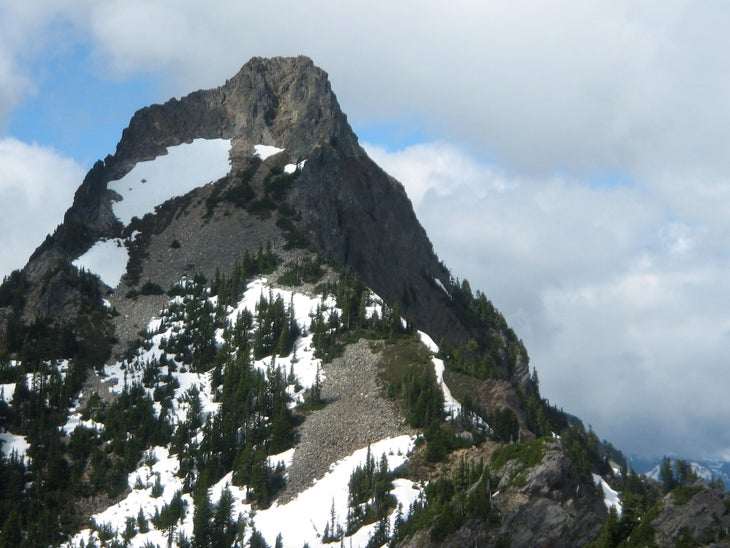
Length: 12 miles
Elevation Gain: 4,500 ft
Trail Type: Out and back
Difficulty: Strenuous
If you want to test your ability to navigate and scramble just a step further than your typical Washington hiking trail will, look no further than Kaleetan Peak, a 6,259-foot summit just 4 miles northwest of Snoqualmie Pass. Start by following the Denny Creek trail up to Melakwa Lake. You’ll have plenty of opportunities along the way to take a dip in the river, or just stop and enjoy the wildflower -filled valley. Melakwa itself is a turquoise-blue alpine lake worth taking a long break at. Continue further up the ridge and follow the faint trail over meadows and boulder fields until you reach the last steep scramble to the summit. The scramble is short, but be careful with kicking loose rock down to people below you. At the summit, you’ll find yourself surrounded by other peaks like 6,238-foot Chair Peak and 5,840-foot Mt. Roosevelt, with no hint of towns or highways for as far as you can see.
Check out the route on Gaia GPS here.
Best Hike In the Olympic National Park: High Divide-Seven Lakes Basin
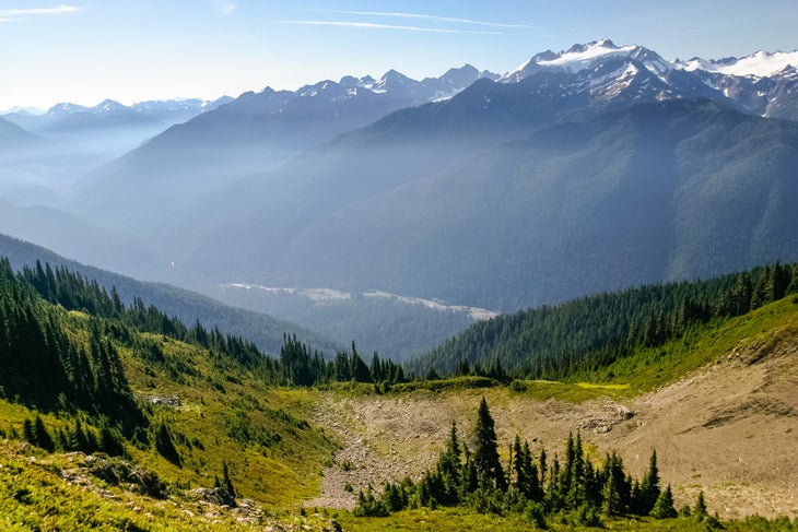
Length: 19 miles
Elevation Gain: 4,000 ft
Trail Type: Lollipop Loop
Difficulty: Strenuous
Out of all the hikes in the Olympic National Park, the High Divide is considered the best by many for its varying scenery and ridge-line route. From the Sol Duc Falls to alpine lakes, this trail takes you on an adventure. If you travel clockwise, the elevation gain will feel moderate and the early journey through the woods is pleasant. Once you start climbing up, you’ll immediately enter subalpine meadows. From Heart Lake, you’ll have one last major uphill climb before traversing the High Divide itself. From the ridge, enjoy views into the basin and out to Mount Olympus. Get your overnight permit in advance, then take the trail down to the lakes to pick your favorite lakeside campsite.
Check out the route on Gaia GPS here.
Best Beach Camping: Hole in the Wall
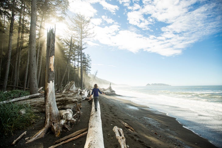
Length: 4 miles
Elevation Gain: 335 ft
Trail Type: Out and back
Difficulty: Easy
Rialto Beach is the best beach backpacking experience for the beginner and those who want a relaxed time in nature. At low tide, check out the marine life within each tide pool, ranging from sea anemones to crabs and sea stars. There is no fresh water, so you must haul your water to your campsite. Once you’ve set up camp, kick back and enjoy the beach life to your heart’s content. If you’re looking for more uncrowded hiking and exploration, continue up the coast past the Hole in the Wall for more unique rock formations. Permits required within Olympic National Park.
Check out the route on Gaia GPS here.
Multi-Day Hikes
Ready to take that PTO and head into the wilderness? These are the hikes for you.
Best Rainforest Hike: Hoh River to Blue Glacier
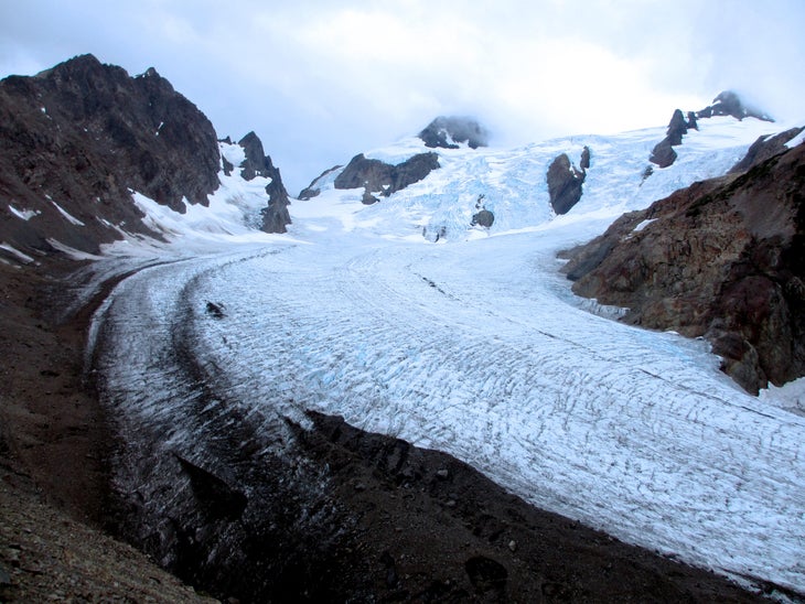
Length: 34 miles
Elevation Gain: 3,700 ft
Trail Type: Out and back
Difficulty: Difficult
The Hoh Rainforest is a must-see for anyone visiting Washington. The PNW rainforests are unlike any other, unique in their temperate weather and filled with bright lime-colored moss straight out of a storybook. Take a couple days to ascend all the way to the Blue Glacier, one of the most popular routes for climbing Mt. Olympus and made up of almost 2 square miles of ice. This is a popular route in summer, so advance campsite reservations are recommended.
Check out the route on Gaia GPS here.
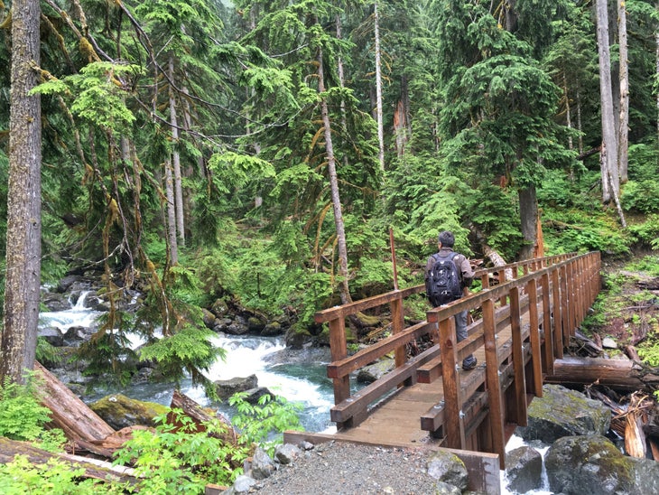
Best Alpine Lakes Overnight: West Fork Foss River
Length: 14.5 miles
Elevation Gain: 4,452 ft
Trail Type: Out and back
Difficulty: Difficult
The West Fork Foss Trail is just one side of the local favorite Necklace Valley Loop, connecting the West Fork to the East Fork. From the trailhead, you’ll feel completely immersed in nature, with plenty of lakes to distract you from the many switchbacks. In the summer, you’ll find innumerable blueberry bushes to snack on. In the fall, vine maples turn the understory a bright red. The West Fork is unique, with many alpine lakes strung together by the trail like a necklace. At each lake, you’ll find many existing campsites to choose from with space for multiple tents and lakeside views. All the lakes here are crystal clear, with a deep blue color.
Check out the route on Gaia GPS here.
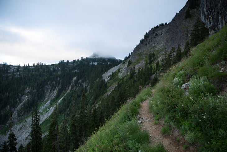
Best PCT Section Hike: Section J PCT
Length: 75 miles
Elevation Gain: 16,000 ft
Trail Type: Point to point
Difficulty: Strenuous
If you have time for just one section of the PCT, section J should be it. From Snoqualmie Pass to Stevens Pass, you’ll head into some of the most varied and beautiful terrain in the Cascades. Most people take around a week to complete this section, and it’s well worth taking your time. It traverses through the Alpine Lakes Wilderness where you can stop by each lake to swim or take a water break. Without becoming technical, the trail takes you to high points and vistas that can be difficult to achieve in a single day hike. Between cozy forests, subalpine meadows, quiet tarns, and views of ridges for miles on end, it’s downright otherworldly.
Check out the route on Gaia GPS here.
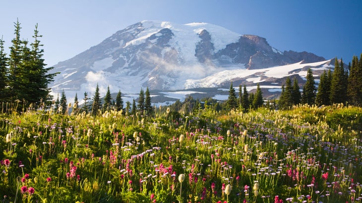
Best Multi-Day Loop – Wonderland Trail
Length: 93 miles
Elevation Gain: 22,000 ft
Trail Type: Loop
Difficulty: Difficult
If you know anything about backpacking in the Pacific Northwest, you probably know about the Wonderland Trail, which crosses forest, meadow, and scree as it circumnavigates Mt. Rainier. Don’t let the length and elevation gain scare you off: most people take over a week to complete it, or backpack it in shorter segments. Make sure your phone or camera is handy: There is no shortage of impressive panoramas along the trail, no matter which segment you choose. If you can plan for it, try to find higher campsites that allow you to have the best views at sunrise and sunset rather than deep forested places. Permits required for camping anywhere in Mt. Rainier National Park.
Check out the route on Gaia GPS here.
