Products You May Like
When the weather is warming but the high country is still under snow, it can be difficult to find a place to scratch that hiking itch. These six trails don’t require a wait. Plus: Three natural wonders you don’t want to miss this spring, and where to find them.
Where to Hike

Mary’s Peak, Siuslaw National Forest, OR
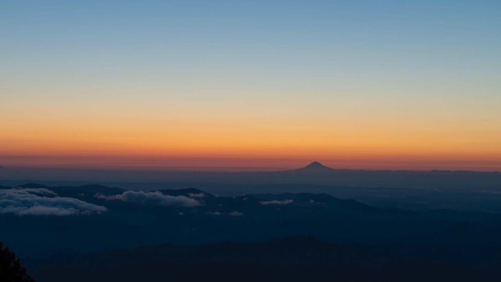
At 4,097 feet, Mary’s Peak is the highest point in the Oregon Coast Range, but not tall enough to be covered by the thick winter snowpack that blankets most of the Pacific Northwest high country. This status makes it a prime early season peakbagging objective. Mary’s Peak is also the most prominent summit west of Corvallis, which translates to 360-degree views: the Pacific Ocean to the west, the Willamette Valley to the east, and the icy peaks of the Oregon Cascades on the far horizon. Spring bonus: Parts of the peak are a designated Scenic Botanical Area, and the meadows near the summit fill with a rainbow of wildflowers every spring and summer.
Distance 9.6 miles Elevation Gain 2,545 feet
Season Year-round Permit None
First Creek Canyon, Red Rock Canyon National Conservation Area, NV
Meet spring early by hiking through the Mojave Desert to a hidden waterfall oasis. The route starts on the desert plain, weaving through cacti and yucca toward distant red-and-white-striped cliffs. Soon you’ll leave the open flatlands behind to head up a canyon and into the cliffs themselves. Pine trees begin to appear as you climb up the split in the rocks beside a streambed that carries water most of the year. The greenery increases as you near your destination: a short waterfall and tranquil green pool hidden in a curve of the cliffs. Cottonwoods and willows shade the oasis while tree frogs croak from the water. This is one of the best spots in the area for spotting wildlife, too, including foxes, burros, and mule deer.
Distance 3.4 miles Elevation Gain 377 feet
Season Year-round Permit None

Delicate Arch, Arches National Park, UT
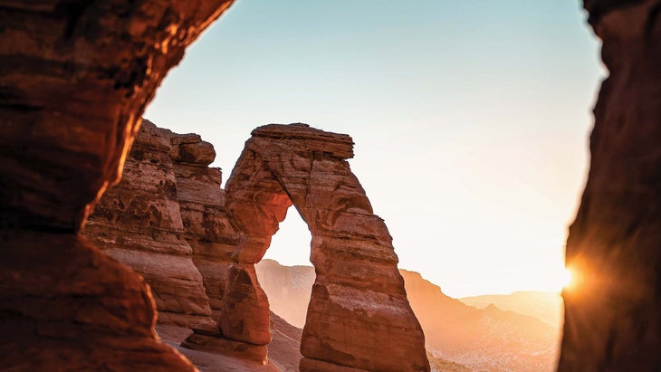
Spring is the perfect time to visit this trail, when the ice is gone but the desert sun hasn’t reached its summer intensity. Go early in the season to avoid the crowds and bask in one of Utah’s most iconic landforms all by yourself. The trail starts with rolling hills before heading up an exposed slickrock slope. Watch for collared lizards here—they like to hunt insects while running on their hind feet. After the climb, the trail levels out, following cairns between enormous sandstone domes. A 200-yard ledge is the last barrier before rounding a corner to find Delicate Arch in all its glory, perched on the edge of a canyon with the snowcapped La Sal Mountains rising in the distance.
Distance 3 miles Elevation Gain 480 feet
Season Year-round Permit Entrance fee required for Arches National Park ($30 per vehicle per week, timed-entry reservation required starting April 3)
Apgar Lookout, Glacier National Park, MT
Climb to one of the best views in this mountain park at Apgar Lookout, a fire tower perched above Lake McDonald at 5,236 feet. The lookout itself is on the register of National Historic Places, but what really stands out is the location and the early season access. While the rest of Glacier’s higher peaks are still under snow, this hike brings you up into the alpine for a glimpse at the crest of the continent. Like all fire lookouts, this one is situated for the best possible panoramic vista. Nestled in the thick green forest below, Lake McDonald dominates the view; behind it rise Glacier’s highest peaks.
Distance 7.1 miles Elevation Gain 1,845 feet
Season Spring, Summer, Fall Permit Entrance fee required for Glacier National Park ($25 per vehicle per week until April 30, then $35)

Welch and Dickey Loop Trail, White Mountain National Forest, NH
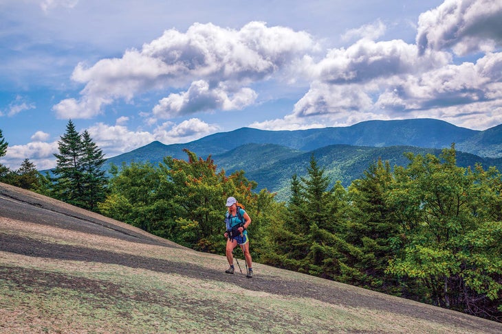
A spring hike that ticks off summits in the notoriously stormy White Mountains? Yes, it’s possible. This loop trail climbs to the tops of 2,605-foot Welch Mountain and 2,734-foot Dickey Mountain, starting and ending in hardwood forest. Both peaks top out with granite slabs and krummholz, giving the loop an alpine feel most early-season hikes can’t achieve. The views from those open summits aren’t bad either, encompassing the southern Whites and the valley between the two mountains. Spring in the lower-elevation forest has plenty of charm, too: The deciduous trees are growing bright green new leaves, and painted trillium and bunchberry bloom on the forest floor below.
Distance 4.4 miles Elevation Gain 1,778 feet
Season Spring, Summer, Fall Permit None
Ouachita National Recreation Trail, Ouachita National Forest, OK and AR
Ready to thru-hike, but Triple Crown trails are still buried under 10 feet of snow? The Ouachita National Recreation Trail is your answer. This path spans the Ouachita Mountains from Talimena State Park in Oklahoma (the western terminus) to Pinnacle Mountain State Park in Arkansas (the eastern terminus). The elevation never climbs above 2,600 feet, making for nearly snow-free spring hiking, but the terrain is still plenty impressive: On its way through the range, the trail winds around rocky hills, ridgetop vistas, and crystal-clear streams in lushly forested valley bottoms over 30,000 feet of elevation change. Well-built campsite shelters and multiple resupply points are a bonus for thru-hikers, but there are plenty of dayhike and weekend sections to try out, too.
Distance 223 miles Elevation Gain 32,276 feet
Season Year-round Permit None
What to See

Sandhill Crane Migration
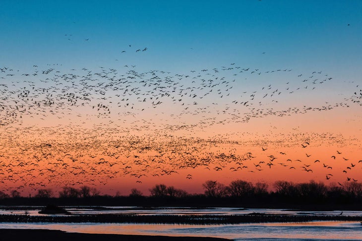
Every year, between February and April, more than 500,000 sandhill cranes descend on a 75-mile stretch of the Platte River in southeast Nebraska. They’re on the Platte to rest and feed as they fly from their southern wintering grounds in northern Mexico to nesting sites as far north as Siberia. The spectacle is more than just visual (though thousands of cranes crowding into a few miles of river is quite a sight): If you time your hike to the migration, the sound will completely envelope you—a cacophony of bird calls and wingbeats as three-fourths of the entire globe’s sandhill crane population congregates on the prairie. These birds—5 feet tall with wingspans of 6.5 feet—have existed nearly unchanged for 2.5 million years. The cranes perform elaborate courtship dances with flapping wings, leaps, and bows, and they mate for life.
Where to catch it: Platte River Valley, NE
The Nature Conservancy Platte River Prairie Nature Trail and Lillian Annette Rowe Sanctuary are hotspots for huge gatherings of sandhill cranes every year, and the Rowe Sanctuary has blinds in place for serious birdwatchers.
Caribou Migration
The nearly 200,000 members of the Porcupine Caribou herd wander thousands of miles through their winter range in Alaska’s far northern uplands. One part of the route always stays the same: The path to the Arctic National Wildlife Refuge’s coastal plain to birth and raise their calves. The young caribou are born in May and early June, and can already run just a few hours after their birth. This relatively flat region of tundra between the Beaufort Sea and the Brooks Range sprouts new growth of sedges and grasses right as calving begins, providing particularly nutritious food during a key part of the caribou lifecycle. The Gwich’in Nation, for whom the Porcupine Caribou Herd has long been a source of food and a cultural foundation, call this spot “Iizhik Gwats’an Gwandaii Goodlit,” which means “Sacred Place Where Life Begins.”
Where to catch it: Arctic National Wildlife Refuge, AK
The Arctic National Wildlife Refuge has no established trails, but you can head into the preserve on foot from Arctic Village or Atigun Pass or charter a bush plane. Plan your route through the coastal plain to meet the caribou.
Lyrid Meteor Shower
The Lyrid meteor shower always brings an end to the annual “meteor drought,” a stretch from January to April when shooting stars are rare. This year it peaks on April 21 and 22, though the whole shower lasts from the 15th to the 29th. In 2022, the Lyrids fall on a quarter moon, so the best time to catch the show is between sunset and moonrise to avoid moonlight washing out your view. The meteors themselves are rocky debris or other particles shed from the tail of yearly celestial visitor Comet Thatcher before burning up (creating the characteristic flare of light) in Earth’s atmosphere. The shower is named for where the meteors appear in the night sky—just above the constellation Lyra. A peak of 10 to 15 meteors per hour is standard, but sometimes bursts of up to 100 per hour can occur.
Where to catch it: White Sands National Park, NM and Canyonlands National Park, UT
When you want an uninterrupted sky view, desert parks are the way to go. Snag an overnight permit for White Sands’ Backcountry Camping Trail or Canyonlands’ Murphy Point.
