Products You May Like
Get full access to Outside Learn, our online education hub featuring in-depth fitness, nutrition, and adventure courses and more than 2,000 instructional videos when you sign up for Outside+
Sign up for Outside+ today.
Boulder may get all the attention, but when it comes to hiking Colorado’s Front Range, there are riches in the hills near Colorado Springs. This entrance point into the state’s mountains offers dozens of options for hiking, whether your sights are set on a short but memorable trek, a challenging day-long excursion, or a multi-day escape.
For many travelers this town is synonymous with Pikes Peak. But there’s much more to Colorado Springs hiking, from partially paved but spectacular hikes through the Garden of the Gods to the challenging endurance test of the Manitou Incline.
Best Dayhikes Near Colorado Springs
Best Hikes Near Colorado Springs: Garden of the Gods and Red Rock Canyon
West Cimarron Street separates the landscapes of the Garden of the Gods and Red Rock Canyon, but the two public parks share an ancient history: an inland sea, acres of dunes, and sandy beaches that left behind the brilliant red spires that enchant hikers today.
Palmer Trail Loop
- Length: 4 miles
- Elevation Gain: 597 feet
- Trail Type: Loop
- Difficulty: Moderate
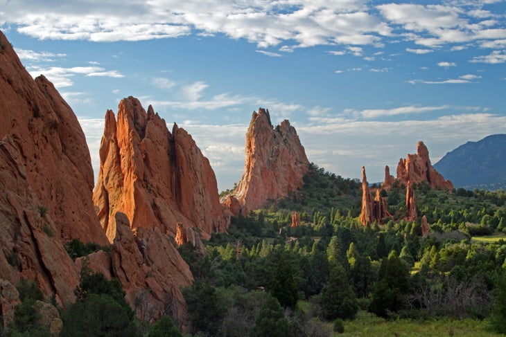
There’s a reason the Garden of the Gods is so popular. Copper-colored rock formations jut from the landscape in otherworldly formations with nicknames like Siamese Twins, Three Graces and Kissing Camels. The Palmer Trail Loop (find the trailhead near the main parking lot) avoids all but a tiny bit of the paved walkway and dodges the worst of the crowds. And the loop’s elevation allows hikers to look out over a wide panorama of the park’s most impressive rock formations.
Find the route on Gaia GPS here.
Red Rock Rim Trail and Red Rock Canyon Trail
- Length: 2.5 miles
- Elevation Gain: 335 feet
- Trail Type: Loop
- Difficulty: Easy
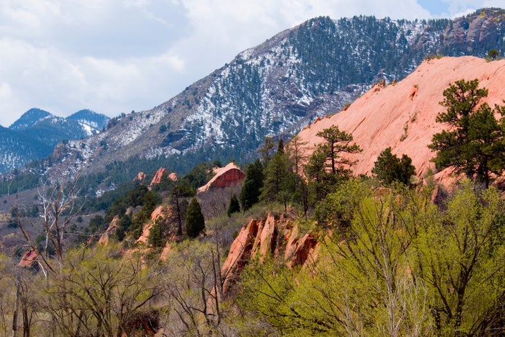
Think of Red Rock Canyon as a mini-Garden of the Gods. Home to similar russet-colored rock hoodoos, slabs and ridges, the canyon was once the site of a quarry that mined building sand, sandstone and gypsum. In the heart of the canyon, rock cuts and retention ponds remain from a century ago, and have become part of the landscape. The entire loop is a memorable and diverse natural experience, with colorful rock walls, exposed grasslands, honey-colored ridgelines and wildlife that frequents the ponds’ shores.
Find the route on Gaia GPS here.
Best Hikes near Colorado Springs: Manitou Springs
The bubbling mineral springs of Manitou Springs have drawn attention since prehistoric times. Today, the town’s location between downtown Colorado Springs, Garden of the Gods and Pikes Peak makes it a good base for exploring the area’s outdoor attractions.
The Incline Trail
- Length: 2 miles
- Elevation Gain: 1978 feet
- Trail Type: Out and back
- Difficulty: Hard
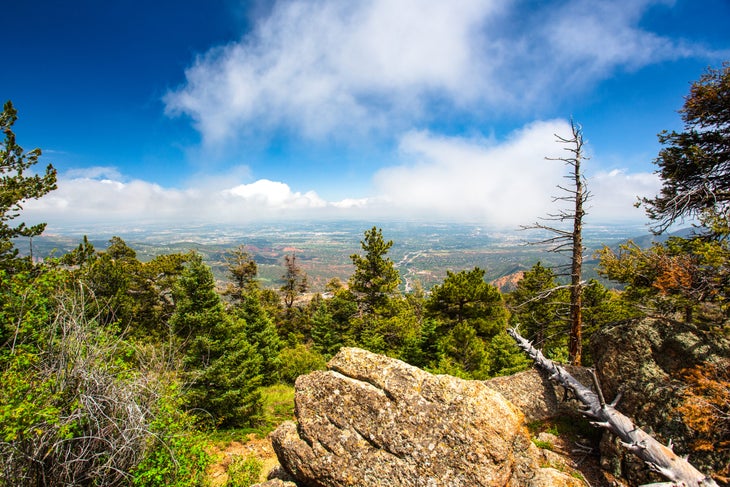
Built on the site of a cog railway that once led to the top of Manitou Mountain, the Incline Trail follows the route of the old tracks with 2,744 rough, uneven stairs that lead one mile straight up. Hiking the route has become a local endurance test, but beyond the bragging rights, the views from the Incline are heavenly. Manitou Springs, Colorado Springs and the plains beyond are nothing short of magnificent, especially in the early morning hours. To accommodate the large number of people who climb The Incline, the City of Colorado Springs has instituted a mandatory free reservation system.
Find the route on Gaia GPS here.
Ute Indian Trail
- Length: 7.5 miles
- Elevation Gain: 2,000 feet
- Trail Type: Out and back
- Difficulty: Moderate
The Ute Indian Trail begins near Manitou Springs’ Incline Trail and, according to local park staff, ranks as one of the oldest migratory routes in the US, dating back approximately 10,000 years. The trail follows a route used to access Ute hunting grounds, trading partners and the sacred waters of Manitou Springs. In the 1860s, the Ute Trail transformed into a wagon road, linking Colorado Springs with the mining camps at Leadville. After a brief but steep incline, the Ute Trail climbs more gradually, passing through ponderosa pine and Douglas fir with spectacular views of Colorado Springs and the plains at points along the way. Interpretive signs point out sites associated with the trail’s long history.
Find the route on Gaia GPS here.
Red Mountain Trail
- Length: 2 miles
- Elevation Gain: 826 feet
- Trail Type: Out and back
- Difficulty: Moderate
A perfect option for those seeking solitude, shade, and scenery with only a short window to hike, the Red Mountain Trail leads up above the town of Manitou Springs, just a short distance from the more popular Incline Trail. After a gradual ascent through scrub oak and grasses, the trail snakes upward through ponderosa pine and Douglas fir before breaking out onto the peak’s exposed rocky summit, with lovely views of the Front Range and Manitou Springs.
Find the route on Gaia GPS here.
Best Hikes near Colorado Springs: North Cheyenne Cañon Park
Located southwest of Colorado Springs, this park is dominated by its 1,000-foot-deep canyon and the creek that carved it, the North Cheyenne. Explore the region’s winding trails and pretty waterfalls just a short drive from downtown.
Seven Bridges Trail
- Length: 3.5 miles
- Elevation Gain: 912 feet
- Trail Type: Out and back
- Difficulty: Moderate
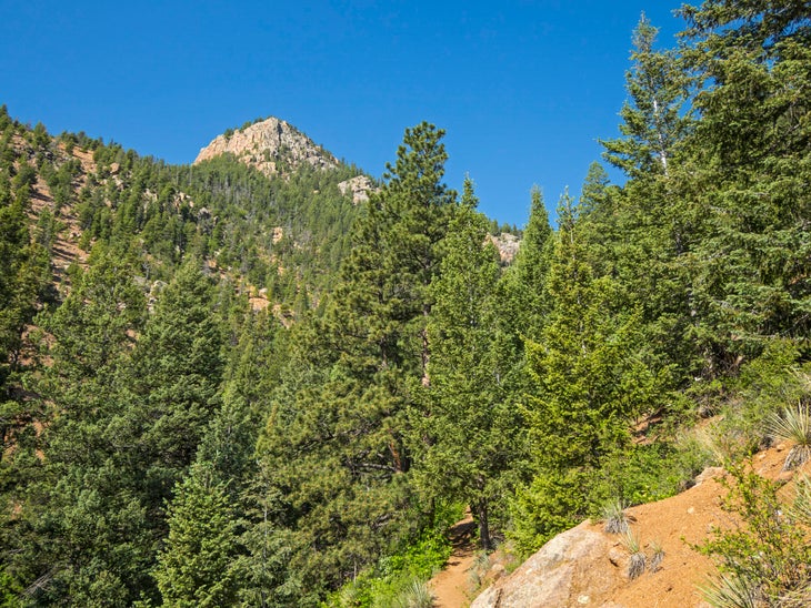
The Seven Bridges Trail follows North Cheyenne Creek, a pretty spring that tumbles through a boulder-strewn cut near the foot of Kineo Mountain. Up and over rocky footpaths, twisted tree roots, and the gurgling creek, the trail offers just enough challenge to be interesting. An added attraction is the path’s seven wooden bridges, which cross over the water and give the route its name. Continue onward to join up with other area trails Forest Service Trail 622A, 668 or 720, or head back after the seventh bridge.
Find the route on Gaia GPS here.
St. Mary’s Falls Trail
- Length: 6.5 miles
- Elevation Gain: 1,395 feet
- Trail Type: Out and back
- Difficulty: Moderate
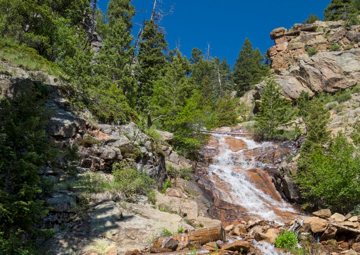
Towering evergreen trees, a pretty creek and two waterfalls attract hikers to this trail that begins in North Cheyenne Cañon Park, southwest of Colorado Springs. Follow the trail’s gradual incline as it winds through Buffalo Canyon and after nearly two miles you’ll encounter the first cascade, the smaller of the two. After three miles, follow the spur to Mount Rosa for terrific views of the surrounding mountains, or continue to the base of the second waterfall, the 300-foot St. Mary’s Falls.
Find the route on Gaia GPS here.
Best Hikes Near Colorado Springs: City Parks
It seems every neighborhood in Colorado Springs lies close to a city park or “open space.” They’re ideal for family hikes, dog walks, an evening workout or opportunities to acclimate to the elevation before hitting the region’s more challenging trails.
Templeton Trail
- Length: 3.9 miles
- Elevation Gain: 860 feet
- Trail Type: Loop
- Difficulty: Moderate
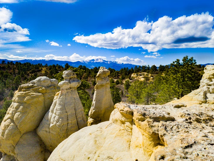
Colorado Springs is home to numerous city parks, many of them crisscrossed by hiking trails.
Palmer Park, set northeast of downtown and traversed by more than 25 miles of trails, is one of the finest. Follow the Templeton Loop to experience the park’s diverse landscapes: wide-open grasslands popular with mule deer, heavily-shaded forest walks, boulder scrambles and exposed red rock overlooks with views of the busy city below.
Find the route on Gaia GPS here.
Ute Valley Black and Blue Loop
- Length: 2.5 miles
- Elevation Gain: 193 feet
- Trail Type: Loop
- Difficulty: Easy
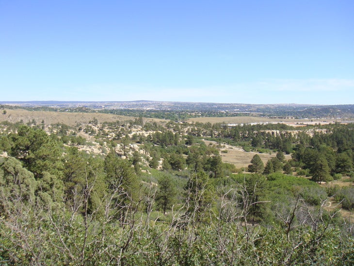
Ute Valley Park lies just north of Colorado Springs. The Black and Blue Loop allows a quick shot of nature and a pleasant hike in the midst of the city, tracing the edges of a gorge and revealing views of the park’s signature rocky outcroppings. Keep an eye out for the park’s mule deer, snakes, and foxes as you walk, as well as colorful birds like the lazuli bunting and green-tailed towhee.
Find the route on Gaia GPS here.
Best Hikes near Colorado Springs: the Royal Gorge Area
An easy drive from the city, Royal Gorge is a popular weekend escape from Colorado Springs. The immensity of this canyon and its scenic 20 miles of trails makes the gorge worth a visit.
Canyon Rim and Far Out Loop
- Length: 7.23 miles
- Elevation Gain: 1,303 feet
- Trail Type: Double lollipop
- Difficulty: Easy
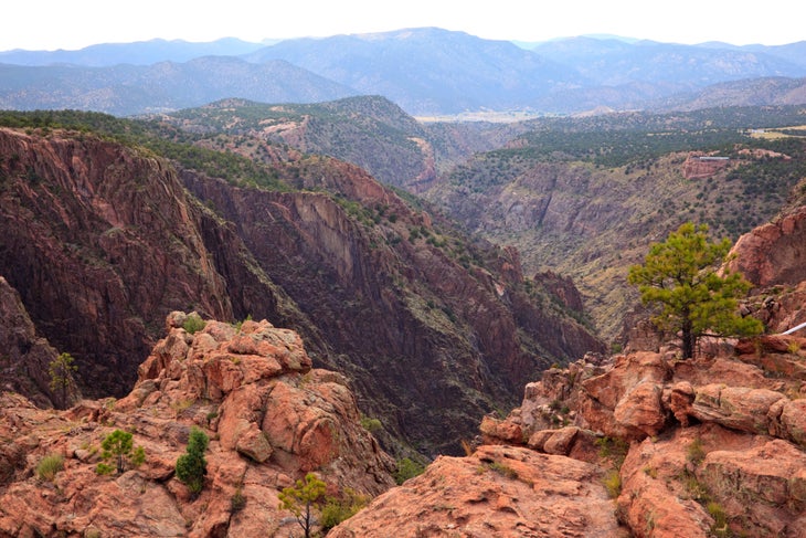
The most popular trail in the Royal Gorge, Canyon Rim follows the lip of the canyon (as its name suggests) to scenic views of the Sangre de Cristo range, the gorge and the Arkansas River along the way. The trailhead sits at the midpoint of Canyon Rim Trail on Route 3A, the main entrance to Royal Gorge Park and less than one mile from the visitors center and attractions at the Royal Gorge Bridge. Take the western lollipop for a shorter hike. The eastern lollipop includes the Far Out lookout point, with some of the most spectacular canyon views in the park.
Find the route on Gaia GPS here.
Made in the Shade
- Length: 3 miles
- Elevation Gain: 380 feet
- Trail Type: Loop
- Difficulty: Moderate
Through evergreen forest, across exposed rose-colored granite, up and over a rocky side canyon of the Royal Gorge, Made in the Shade offers a lot of spectacular scenery and variety in its short 3 miles. To the west, you’ll see the peaks of the Sangre de Cristo range, but your gaze will frequently be drawn downward, where the soil sparkles with shards of mica, quartz, and fool’s gold. This trail is also popular with mountain bikers.
Find the route on Gaia GPS here.
Best Weekend Backpacking Trips near Colorado Springs
Located on the edge of the Front Range and just over an hour from Denver, you’ll find dozens of options for hiking trips of a weekend or more. But if time is tight and you’d rather rack up miles in your boots than on your odometer, you’ll find good choices within an easy reach of the city.
Pikes Peak on the Barr Trail
- Length: 25 miles
- Elevation Gain: 7,434 feet
- Trail Type: Out and back
- Difficulty: Hard
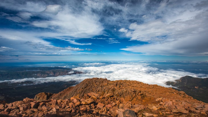
The quintessential ascent of Pikes Peak will test the endurance of even the best hikers. Begin your hike in the pleasant town of Manitou Springs, where shuttle service is available to transport you to the trailhead. Constructed in the early 1900s and well-marked (provided snow cover doesn’t obscure the path), the Barr Trail begins with a bang, gaining some 4,000 feet in the first 6 miles. The route reaches Barr Camp at the midway point, a popular stop for those who want to make a multi-day trip of the excursion. Three miles from the summit the trail reaches its most difficult stretch, with tight switchbacks and rock scrambles that lead to the hike’s ultimate reward: the summit of Pikes Peak and knockout 360-degree views of the Rocky Mountains.
Find the route on Gaia GPS here.
The Crags and Devil’s Playground Trails
- Length: 14.5 miles
- Elevation Gain: 4,403 feet
- Trail Type: Out and back
- Difficulty: Hard
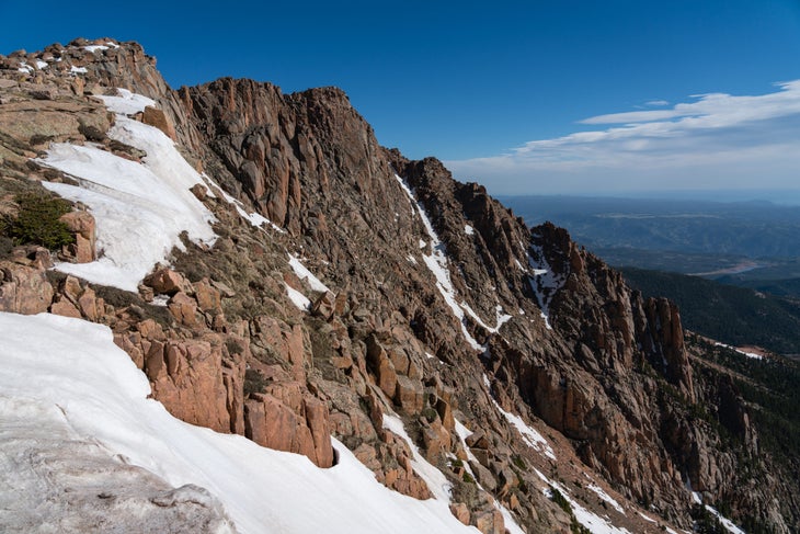
Hiking Pikes Peak from its western flank is the lesser-known route up Colorado’s famous summit, but beginning your ascent from Crags Camp means you’ll be able to start 3,000 feet higher than if you were to follow the Barr Trail. The route begins with a hike along Crags Trail, a popular, moderately difficult route brightened by wildflowers in spring and brilliant foliage in fall. The hike becomes more challenging once it merges with Devil’s Playground. Follow the long gradual climb to the summit for unsurpassed mountaintop views overlooking Colorado Springs.
Find the route on Gaia GPS here.
Ring the Peak Trail
- Length: 50 miles
- Elevation Gain: 1,650 feet
- Trail Type: Out and back
- Difficulty: Moderate
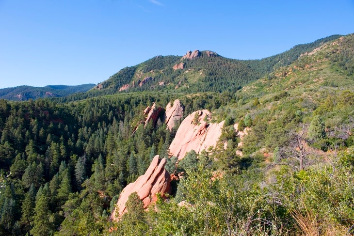
Still a work in process, the Ring the Peak Trail aims to completely encircle Pikes Peak when it’s finished for a total distance of around 75 miles. But much of the trail is already in place. The current upside-down U-shaped trail begins near the town of Divide and ends just south of Manitou Springs. There are numerous access points along the route and good signage, with green arrows guiding those traveling the route counterclockwise and brown arrows guiding those traveling clockwise. Popular Ring the Peak segments include Pancake Rocks near Cripple Creek, The Crags, and the Intemann Trails.
Find the route on Gaia GPS here.
Hiking Near Colorado Springs: Gear Advice
So it’s warm and sunny in the city? That doesn’t mean it’ll be warm and sunny on the trail. Just an hour from Colorado Springs, higher elevations may produce snow, even in summer. The area’s thinner air can result in sunburn and dehydration even on the coldest of days, and ridgeline treks can see powerful wind gusts. Dress in layers, and always bring a water-resistant shell, hat and gloves just in case. If you’re hiking in late winter or early fall, consider packing microspikes for high-elevation hikes, and always pack more water than you think you’ll really need.
